
What is recorded here
Built against rock outcrop, in slight depression. Random-rubble limestone walls encase core (c. 8m NW-SE; c. 6m NE-SW). Partially overgrown front elevation (H 5.5m) faces SE, with arched recess (H 1.57m; Wth 2.3m; D 1.71m). Corbelled stones to rear of recess partially collapsed, sloping slabs beneath with blocked stoking hole cut into slab; rectangular ope (Wth c. 0.63m) at base. Iron brackets in front wall, over recess. Top of kiln closed off by wall (H 1.1m) with ope (Wth 2.26m) giving access to funnel area. Funnel infilled. Scatter of coal/culm beside front of kiln.
The above description is derived from the published 'Archaeological Inventory of County Cork. Volume 4: North Cork' (Dublin: Stationery Office, 2000). In certain instances the entries have been revised and updated in the light of recent research.
Date of upload/revision: 14 January 2009
The monument record does not grant public access. Check the route and ask the landowner before entering private land.
- What survives
- Recorded monument
Places near here
 Earthwork in Ballybeg EastEarthwork · 434 yd
 Ballybeg Abbey (in Ruins)Religious house, Augustinian canons · 441 yd
 MillMill, unclassified · 482 yd
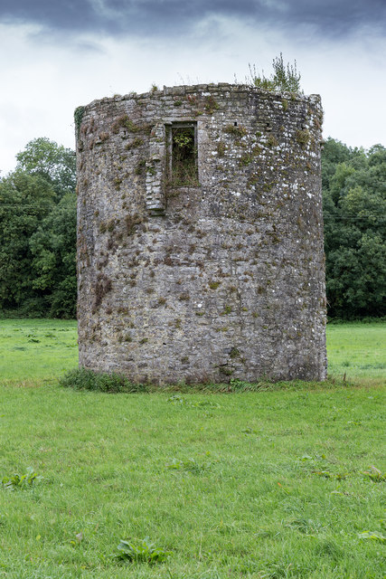 TowerDovecote · 495 yd
 Charles BunworthMemorial · 905 yd
 Lombards CastleCastle, tower house · 1246 yd
 SycamoreSycamore · 1741 yd
 David HurleyMemorial · 1742 yd
 Bawn of Kilmaclenine (in Ruins)House, fortified house · 2.3 mi
 Lady's WellSpring · 3.3 mi
 Smith's WellSpring · 3.6 mi
 Doneraile HouseHeritage attraction · 3.9 mi
Other information
Photo: Credit not shown in the picture search · Rights wording not checked; contact us if this picture should be removed