What is recorded here
In Riverstown, on S bank of Glashaboy river. Early/mid-19th century complex marked 'Distillery' on 1842 OS 6-inch map, of which only two buildings remain. Rectangular gable-ended structure built into slope, known locally as "the maltings". Four-storey N elevation, 11 bays. S elevation of 3 storeys; camber-headed brick-arched windows. Wide central doorway on each floor of W gable. Three-storey rectangular structure to NW (long axis E-W), adjacent to stream; elevation of 12 bays; now used as garage. Complex named' Brewery' on 1902 OS 6-inch map, indicating change in function.
In Riverstown, on S bank of Glashaboy river. Early/mid-19th century complex marked 'Distillery' on 1842 OS 6-inch map, of which only two buildings remain. Rectangular gable-ended structure built into slope, known locally as "the maltings". Four-storey N elevation, 11 bays. S elevation of 3 storeys; camber-headed brick-arched windows. Wide central doorway on each floor of W gable. Three-storey rectangular…
From the National Monuments Service (Archaeological Survey of Ireland) record CO075-003
The monument record does not grant public access. Check the route and ask the landowner before entering private land.
- What survives
- Recorded monument
Places near here
Photo credits
- National Inventory of Architectural Heritage
- David Hawgood, Geograph · Creative Commons Attribution-ShareAlike 2.0
- Raúl Corral, Wikimedia Commons · CC BY-SA 3.0
- MrCorman, Wikimedia Commons · CC BY-SA 4.0
 Copperalley BridgeBridge · 245 yd
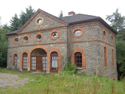 outbuilding360 ydArchitectural fragment in BallinglannaArchitectural fragment · 1184 ydOld Court (Site of)Castle, unclassified · 1499 ydVienna WoodsWood · 1.3 miCarberrytown WoodWood · 1.4 miGlanmire Heritage SocietyMemorial · 1.6 mi
 Graveyard1.6 miCork WalksVisitor information · 1.8 miCork WalksVisitor information · 2.0 mi
 Blackrock CastleCastle, tower house · 2.0 mi
 Blackrock CastleHeritage attraction · 2.0 mi
More archaeology and monuments in County Cork · All of County Cork
What do you know about this place?