What is recorded here
Situated on a gentle to marked S-facing mountain slope in forestry. A quadrangular area (dims. 40m x 30m) enclosed by a low but substantial stone wall (H 1m; Wth 1.6m). There is an internal ditch on the S side and an external ditch (Wth 1m; D 0.5m) on the NE side. There is a stone-lined entrance (Wth 1m) at E. (O'Sullivan and Warren 2005, 4; O'Sullivan and Warren 2007, 474-5)
Compiled by: Matt Kelleher
Date of upload: 11 January 2013
From the National Monuments Service (Archaeological Survey of Ireland) record WI016-009002
The monument record does not grant public access. Check the route and ask the landowner before entering private land.
- What survives
- Recorded monument
Places near here
Photo credits
- Ian Paterson, Geograph · CC BY-SA 2.0
- Pampuco, Wikimedia Commons · CC BY-SA 4.0
- Joe King, Wikimedia Commons · CC BY-SA 3.0
- National Inventory of Architectural Heritage
- Crispin Purdye, Wikimedia Commons · CC BY-SA 2.0
- Mike Searle, Geograph · CC BY-SA 2.0
- XeresNelro, Wikimedia Commons · CC BY-SA 4.0
- 1ivia, Wikimedia Commons · CC BY 2.0
- Rafesmar, Wikimedia Commons · CC BY-SA 4.0
- No machine-readable author provided. Haraldius~commonswiki assumed (based on copyright claims)., Wikimedia Commons · CC BY-SA 2.5
 Fair MountainMountain / peak · 1.4 miArt O'Neill PlaqueMemorial · 1.8 mi
 Wicklow GapMountain pass · 2.1 mi
 TonelageeMountain / peak · 2.4 mi
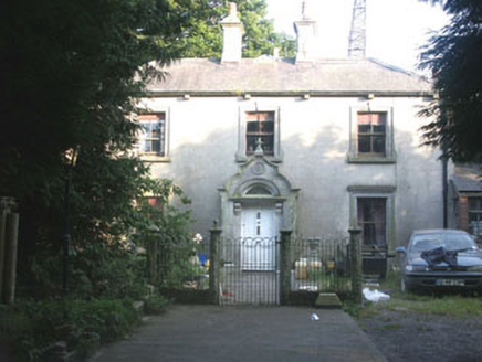 Granite HouseHouse · 3.9 mi
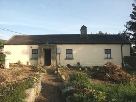 Saint Anthony'sHouse · 4.1 mi
 Glenmacnass WaterfallWaterfall · 4.3 mi
 Hampden Bomber Crash 18 April 1941Monument · 4.4 mi
 GlendaloughViewpoint · 4.9 mi
 Poulanass WaterfallWaterfall · 5.6 mi
 CloigtheachRound tower · 5.7 mi
 Glendalough Round TowerHeritage attraction · 5.7 mi
More archaeology and monuments in County Wicklow · All of County Wicklow
What do you know about this place?