
What is recorded here
From the National Monuments Service (Archaeological Survey of Ireland) record WI023-008002
The monument record does not grant public access. Check the route and ask the landowner before entering private land.
- What survives
- Recorded monument
Places near here
 Glendalough Round TowerHeritage attraction · 1 yd
 G. YardGraveyard · 53 yd
 The Priests Church or St. Kevins Library (in RuinsChurch · 68 yd
 Stone CrossCross, High cross · 85 yd
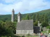 GlendaloughHeritage attraction · 116 yd
 St. Kierans Church (in Ruins)Church · 134 yd
 Poulanass WaterfallWaterfall · 1648 yd
 MullacorMountain / peak · 2.6 mi
 CamaderryMountain / peak · 2.7 mi
 Battle of GlenmalureMajor battlefield · 3.6 mi
 Wicklow GapMountain pass · 3.6 mi
 Glenmacnass WaterfallWaterfall · 3.7 mi
Pictures: No machine-readable author provided. Haraldius~commonswiki assumed (based on copyright claims)., Wikimedia Commons · CC BY-SA 2.5; Joseph Mischyshyn, Wikimedia Commons · CC BY-SA 2.0; Hscheff, Wikimedia Commons · CC BY-SA 4.0; Millars, Wikimedia Commons · CC BY-SA 4.0; Schcambo at English Wikipedia, Wikimedia Commons · CC BY 3.0; 1ivia, Wikimedia Commons · CC BY 2.0; Pampuco, Wikimedia Commons · CC BY-SA 4.0; Wikimedia Commons contributor · Public domain; The Vicious Chicken of Bristol, Wikimedia Commons · CC BY-SA 4.0; Crispin Purdye, Wikimedia Commons · CC BY-SA 2.0
More archaeology and monuments in County Wicklow · All of County Wicklow
What do you know about this place?