
What is recorded here
Now incorporated into a green area within Moreen Housing Estate. This feature extends roughly N-S direction and survives in two sections. It comprises a flat-topped bank with a fosse on either side (L 220m). The bank is better preserved in the S (Wth Top 3-4m, Wth Base 6m, H 1.2m). The fosses are mostly silted up (Wth…
Read the whole record
From the National Monuments Service (Archaeological Survey of Ireland) record DU022-064
Places near here
Picture notes
- Computer-made picture. It does not show this monument.
- Computer-made picture. It does not show this playground.
- National Inventory of Architectural Heritage
- Computer-made picture. It does not show this garden.
- Gabriel Beranger (ca.1729-1817), Wikimedia Commons · Public domain
- Wikimedia Commons contributor · Public domain
- Percita at Flickr, Wikimedia Commons · CC BY-SA 2.0
- Vadim Manuylov, Wikimedia Commons · CC BY-SA 3.0
- JP, Geograph · CC BY-SA 2.0
- Joe King, Wikimedia Commons · CC BY-SA 3.0
 Church (site of)Ecclesiastical enclosure · 227 ydComputer-made picture
Explorer Tom Balally’s church enclosure used to be a massive earthen bank, but the developers levelled it like it was a minor inconvenience. It’s gone now, leaving behind nothing but a memory and some very smug modern housing. Tell it a joke, it's been a long time since anyone did.
 Children's playground248 ydComputer-made picture
Explorer Tom Another Children's playground in County Dublin. No details, so I'm making this up: a local legend says the sandbox hides a lost leprechaun shoe. Check it out.
 Watchtower in BalallyWatchtower · 435 ydComputer-made picture
Explorer Tom A watchtower in Balally that nobody can find? I bet the bird living in the wall refuses to leave. It’s guarding something important, or maybe just a lost sock. Stand still and listen, the wind tells it better than me.
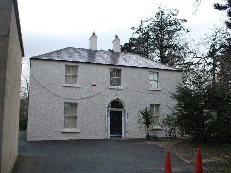 Saint Mary's Catholic ChurchPresbytery/parochial/curate's house · 451 yd
Explorer Tom Saint Mary's Catholic Church presbytery in Balally is a compact two-storey box with a Classical doorcase, restored recently so it’s all tidy. Built for the priests, it’s got stepped chimneys. Show me that good quality workmanship!
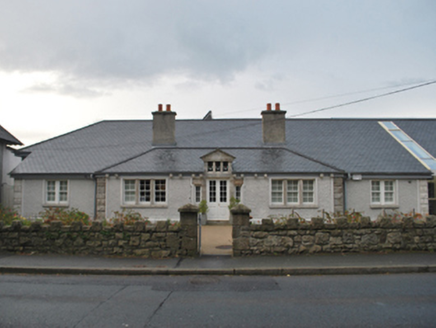 Sandyford Carnegie Free LibraryLibrary/archive · 680 yd
Explorer Tom Sandyford Carnegie Free Library is bragging about surviving storms that never happened, thanks to its straightforward design by Rudolph Maximilian Butler. It’s not fancy, just effective, like a good sandwich. Right now, it’s probably judging your reading list from across the street.
 Fernhill Community GardenGarden · 1377 ydComputer-made picture
Explorer Tom Fernhill Community Garden in County Dublin sounds like a hill made of ferns and community spirit. Nothing on file means it might be just dirt and hope. Check if any ferns are actually trying to hug you. It’s weird but lovely.
 Kilgobbin Castle (in ruins)Castle, tower house · 1.1 mi
Explorer Tom Kilgobbin Castle in Kilgobbin is an impressive granite tower house that was nearly sold for a horse in some wild tale I made up. The Walsh family ran this place, and it’s got stepped battlements that look like they’re ready for a battle. Have a look and decide if I was lying to you.
_(cropped).jpg/250px-Kilgobbin_Castle,_County_of_Dublin,_1834_(IA_jstor-30004185)_(cropped).jpg "Photo: Wikimedia Commons contributor · Public domain") Kilgobbin CastleCastle · 1.1 mi
Kilgobbin CastleCastle · 1.1 miExplorer Tom Kilgobbin Castle in County Dublin has got an 1834 drawing hanging around, which makes it feel like a real old-timer. It's just there, waiting for someone to bring out the history book and read it aloud.
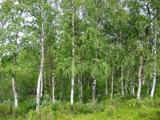 Silver Birch1.1 mi
Explorer Tom Silver Birch in County Dublin has that pale skin thing going on, which is either elegant or just sunburned. Stand on the spot and imagine the gossip it’s heard about every dog that passed by.
 Monterey Cypress1.1 mi
Explorer Tom Monterey Cypress in County Dublin looks like it's trying very hard to look Mediterranean. A local legend says a giant sneezed and planted it by accident. Stand where the owner stood and practise looking smug.
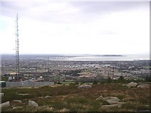 Three Rock MountainMountain / peak · 1.6 mi
Explorer Tom Three Rock Mountain in County Dublin is buzzing with radio waves from its transmitter station, overlooking the bay. It’s basically a giant antenna pretending to be a peak, so don’t touch it unless you fancy sparks. Snap a pic!
 KilmashogueMountain / peak · 2.0 mi
Explorer Tom Kilmashogue is part of the Dublin Mountains and looks great from the southeast. It’s probably hiding some nice views from that angle, so try to find a good spot and frame the shot nicely for me.
More archaeology and monuments in County Dublin · All of County Dublin

What do you know about this place?Tap to add a comment or ask a question