What is recorded here
In pasture, on E-facing slope below brow of ridge. Key-hole shaped area (circle to S: 72m E-W; 74m N-S; rectangular projection to N: 35m E-W; 28m N-S) defined by a scarped edge (H 1.6m; Wth 6.5m) NNW->SSE and enclosed by earth-and-stone bank (int. H 0.8m; ext. H 1.05m) SSE->NNW. Dry-stone wall runs along top of bank SW->NW and along top of scarped edge NNE->ENE. East half on interior slopes down to E; an earth-and-stone bank (H 0.50m; L 24m), on N-S axis, marks this break in slope on S side.
In pasture, on E-facing slope below brow of ridge. Key-hole shaped area (circle to S: 72m E-W; 74m N-S; rectangular projection to N: 35m E-W; 28m N-S) defined by a scarped edge (H 1.6m; Wth 6.5m) NNW->SSE and enclosed by earth-and-stone bank (int. H 0.8m; ext. H 1.05m) SSE->NNW. Dry-stone wall runs along top of bank SW->NW and along top of scarped edge NNE->ENE. East half on interior slopes down to E; an…
From the National Monuments Service (Archaeological Survey of Ireland) record LI011-094
The monument record does not grant public access. Check the route and ask the landowner before entering private land.
- What survives
- Recorded monument
Places near here
Photo credits
- National Inventory of Architectural Heritage
- Wikimedia Commons contributor · Public domain
- Peter Gerken, Wikimedia Commons · CC BY-SA 2.0
- This file is from the Mechanical Curator collection , a set of over 1 million images scanned from out-of-copyright books and released to Flickr Commons by the British Library. View image on Flickr View all images from book View catalogue entry for book ., Wikimedia Commons · Public domain
- Sitomon, Wikimedia Commons · CC BY-SA 2.0
- Mike Searle, Wikimedia Commons · CC BY-SA 2.0
- Miguel Angel Masegosa Martínez, Wikimedia Commons · CC BY 2.0
 Ballindeel HouseRectory/glebe/vicarage/curate's house · 907 yd
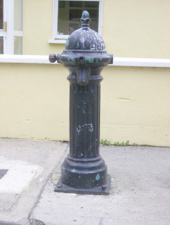 water pump1012 ydGrave YardGraveyard · 1076 ydAskeatonHistoric town · 1208 yd
 Askeaton CastleHeritage attraction · 1261 ydHolly IslandIslet · 2.6 mi
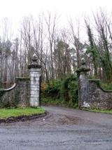 Curraghchase Forest ParkForest · 3.6 mi
_p171_LIMERICK_-_CAPPAGH_CASTLE.jpg/250px-NEWENHAM(1830)_p171_LIMERICK_-_CAPPAGH_CASTLE.jpg "Photo: This file is from the Mechanical Curator collection , a set of over 1 million images scanned from out-of-copyright books and released to Flickr Commons by the British Library. View image on Flickr View all images from book View catalogue entry for book ., Wikimedia Commons · Public domain") Cappagh CastleCastle · 3.7 mi
Cappagh CastleCastle · 3.7 mi European Yew3.8 mi
_-_geograph.org.uk_-_6276707.jpg/250px-Castles_of_Munster,_Dysert,_Limerick_(1)_-_geograph.org.uk_-_6276707.jpg "Photo: Mike Searle, Wikimedia Commons · CC BY-SA 2.0") Dysert CastleCastle · 4.0 miHerring RockNamed rock · 4.5 mi
Dysert CastleCastle · 4.0 miHerring RockNamed rock · 4.5 mi Sweet Chestnut6.1 mi
More archaeology and monuments in County Limerick · All of County Limerick
What do you know about this place?