What is recorded here
Map note: Kiln in Aghnameadle is a kiln around Aghnameadle, County Tipperary, Ireland. A little curiosity is allowed; the map will show what is nearby.
Disused and covered in lime kiln of 19th century date built into W face of hillock in upland area.
From the National Monuments Service (Archaeological Survey of Ireland) record TN022-050
Places near here
Picture notes
- Computer-made picture. It does not show this monument.
- National Inventory of Architectural Heritage
- Computer-made picture. It does not show this mountain top.
- Computer-made picture. It does not show this playground.
- Mike Searle, Wikimedia Commons · CC BY-SA 2.0
 Fairy fort / earthen ringfort in AghnameadleFairy fort / earthen ringfort · 417 ydComputer-made picture
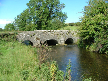 Aghnameadle BridgeBridge · 826 yd
 TombTomb, unclassified · 1017 ydComputer-made picture
 Aghnameadle Church (in Ruins)Graveyard · 1025 ydComputer-made picture
 Moated site in CloncannonMoated site · 1163 ydComputer-made picture
 Fairy fort / earthen ringfort in BallinvenyFairy fort / earthen ringfort · 1167 ydComputer-made picture
 Standing stone in AghnameadleStanding stone · 1168 ydComputer-made picture
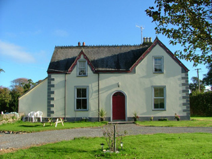 Barnagrotty HouseFarm house · 1.0 mi
 KnockahilliganMountain / peak · 1.3 miComputer-made picture
 Children's playground2.5 miComputer-made picture
 Knockane CastleCastle · 2.9 mi
 LatteraghMountain / peak · 3.2 miComputer-made picture
More historic places in County Tipperary · All of County Tipperary

What do you know about this place?Tap to add a comment or ask a question