DDiscover AloneMapAbout

Bawn in Aghnahoo Glebe

Bawn

The bawn's east and west walls, corner towers and wall footings survive beside the ruined tower-house. The monument record does not grant public access. Check the route and ask the landowner before entering private land.

What survives
Standing bawn wall and tower ruins
What do you know about this place?Tap to add a comment or ask a question

What you write will be public.

What is recorded here

Located on the NW side of a tower house (DG105-014001-) and associated with a settlement cluster (DG105-014002-). The lands of Termon McGrath were granted to James, son of Archbishop Myler McGrath in 1610 (Hill 1877, 183-4). In 1611 Carew records that the 'Archbishop of Cashill hath begune a prittie castle at Termon…

Read the whole record
Located on the NW side of a tower house (DG105-014001-) and associated with a settlement cluster (DG105-014002-). The lands of Termon McGrath were granted to James, son of Archbishop Myler McGrath in 1610 (Hill 1877, 183-4). In 1611 Carew records that the 'Archbishop of Cashill hath begune a prittie castle at Termon Magragh w'ch he entends speedily to finish, havinge his materials ready at the place wher he meanes to buyld a bawne and finish the castle' (Hunter 1975, 82). In the campaign of 1649-50 Termon McGrath Castle was bombarded by Cromwellian troops and the N wall of the tower-house destroyed; it has remained a ruin ever since (Rowan 1979, 453). The ruins comprise a tower-house (DG105-001-) and bawn (DG105-014003-) sited where the Waterfoot and Termon rivers enter Lough Erne. The bawn (DG105-014003-) is roughly L-shaped in plan, the maximum dimensions being c. 27m x 27m; it is enclosed by a wall of roughly-coursed blocks and split stone rubble laid in mortar, and abuts the NE and SW corners of the tower-house. It was protected by two circular two-storey towers at the NE and NW corners; these were entered from the bawn by lintelled doorways with drawbar holes. They were fitted with gun-loops on both levels. Only the lower courses of the SE corner of the bawn wall remain. The E wall is c. 3m-4m in height and preserves indications for seven gun-loops. There is a splayed opening at ground level at the N end of this wall; its function is unclear. At the S end of the wall, opposite the tower, the wall is off-set 2.1m above present ground level which together with a corbel-like projection of mortared stones indicates a possible wall-walk or super-structure in this area. There are traces of a shallow fosse outside the E and SE bawn wall. The SW section of bawn wall is represented by footings. The W wall c. 2.5m-3.5min height has five gun-loops and had a small contemporary building near its S end; no visible trace of the E extent of this structure survives. The foundations of the N wall remain with traces of a central gate. A road, c. 4.3m wide and delineated by rubble blocks, leads N from the gate for c. 100m. The above description was derived from the 'Archaeological Survey of County Donegal. A description of the field antiquities of the County from the Mesolithic Period to the 17th century.' Compiled by: Brian Lacey with Eamon Cody, Claire Cotter, Judy Cuppage, Noel Dunne, Vincent Hurley, Celie O'Rahilly, Paul Walsh and Seán Ó Nualláin (Lifford: Donegal County Council, 1983).

From the National Monuments Service (Archaeological Survey of Ireland) record DG105-014003

Places near here

Photo credits
  • Mcg sean, Wikimedia Commons · CC BY-SA 3.0
  • Maker not stated on source page, ru.pinterest.com
  • National Inventory of Architectural Heritage
  • Kmcnamee, Wikimedia Commons · CC BY-SA 4.0
  • Maker not stated on source page, www.pinterest.com
  • Kenneth Allen, Geograph · CC BY-SA 2.0
  • Maker not stated on source page, www.tripadvisor.com.ph
Castle McGrathCastle · 3 yd

Explorer Tom Castle McGrath is recorded as a castle in County Donegal, and its location near Termonmcgrath gives it a solid…

Fairy fort / earthen ringfort in DrumharriffFairy fort / earthen ringfort · 1335 yd

Explorer Tom Fairy fort / earthen ringfort in Drumharriff is basically just a slight bump and some faint ditch traces on the…
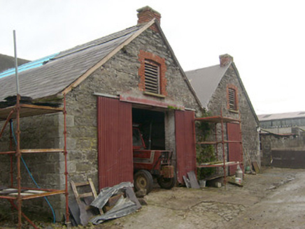
outbuilding1356 yd

Explorer Tom Outbuilding in Aghafoy looks like two very serious boxes that forgot to hug. Built around 1880, I reckon those red…

Páirc na Scoile, Pettigo GAAGAA ground · 1591 ydSt. Mary's Catholic ChurchChurch/chapel · 1.1 mi

Explorer Tom St. Mary's Catholic Church in Pettigo saw its most dramatic moment when a pigeon flew into the organ during Sunday…

Mapped graveyardGraveyard · 1.1 mi

Explorer Tom This mapped graveyard would give you two stars for visiting, three if you brought biscuits, and one if you stepped on…

The Fisherman's LodgeSchool · 1.2 mi

Explorer Tom The Fisherman's Lodge in Pettigo would win a county fair for best dressed, even if it used to be a school. The old…

Pettigo InnRestaurant · 1.2 mi

Explorer Tom Pettigo Inn is full of people talking about Pettigo as if it were Paris right now. Nod along and order the special; you…

goods shed1.2 mi

Explorer Tom Goods shed in Drumharriff has an infilled round-headed arch that used to let engines roll right inside. Built c. 1866…
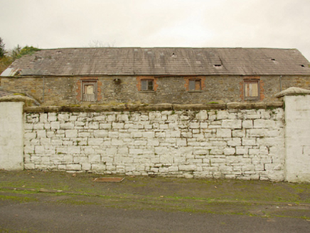
The Market YardMarket building · 1.2 mi

Explorer Tom The Market Yard in Pettigo is where someone once wrote a truly awful poem about selling cabbages. It’s neglected now…

Drumharriff - Forest StrollOfficial walking route · 1.2 mi

Explorer Tom Drumharriff - Forest Stroll in County Donegal has a favourite song, which is a slow, sad hum that the trees seem to…

Britton’s BarPub · 1.2 mi

Explorer Tom Britton’s Bar in Pettigo dates from eighteen sixty and smells like old wood and last calls. It is your final chance to…

More castles and forts in County Donegal · All of County Donegal

Add to this placeAdd a picture Add a detailed tip Add a story

Explore the map1,095,414 places to discover

Next place · or swipeCastle McGrath