What is recorded here
On a gentle S facing slope, within a forested area, to N of a stream. An oval enclosure (int diams. 27m N-S; 23m E-W) defined by an earth and stone bank best preserved at the SW (Wth 3m; int H 0.3m; ext H 0.6m) where ground falls away, and W (Wth 2.8m; int H 0.6m; ext H 0.3m). The bank is difficult to define at the N and S, and also at the E where a forestry track skirts the circumference. At the NE the enclosing element appears to be absent. The interior is reasonably level and was covered with grass, bracken and bluebells at time of inspection.
On a gentle S facing slope, within a forested area, to N of a stream. An oval enclosure (int diams. 27m N-S; 23m E-W) defined by an earth and stone bank best preserved at the SW (Wth 3m; int H 0.3m; ext H 0.6m) where ground falls away, and W (Wth 2.8m; int H 0.6m; ext H 0.3m). The bank is difficult to define at the N and S, and also at the E where a forestry track skirts the circumference. At the NE the enclosing…
From the National Monuments Service (Archaeological Survey of Ireland) record WI029-023
The monument record does not grant public access. Check the route and ask the landowner before entering private land.
- What survives
- Recorded monument
Places near here
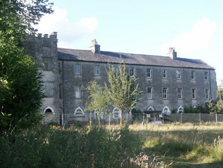 Aghavannagh BarrackBarracks · 1083 ydIndicatedFairy fort / earthen ringfort · 1660 ydThe Stripped FlagsNamed rock · 1.4 miDrumgoff Forest Recreation AreaForest · 1.4 mi
 CroaghanmoiraMountain / peak · 2.0 miFont in RosahaneFont · 2.3 mi
 CorrigasleggaunMountain / peak · 2.9 miMichael Dwyer & Fiach McHugh 0'ByrneMemorial · 3.3 miDwyer's RockCliff · 3.4 miKavanagh Brothers' GraveMemorial · 3.5 mi
 Battle of GlenmalureMajor battlefield · 3.6 mi
 Saint John's Church (Moyne)Church/chapel · 4.6 mi
Pictures: National Inventory of Architectural Heritage; Britishfinance, Wikimedia Commons · CC BY-SA 4.0; Schcambo at English Wikipedia, Wikimedia Commons · Public domain; The Vicious Chicken of Bristol, Wikimedia Commons · CC BY-SA 4.0; Ridiculopathy, Wikimedia Commons · CC0
More archaeology and monuments in County Wicklow · All of County Wicklow
What do you know about this place?