What is recorded here
From OpenStreetMap (© OpenStreetMap contributors) w219576458
Places near here
Photo credits
- Phil Champion, Geograph · CC BY-SA 2.0
- National Inventory of Architectural Heritage
- Garry Dickinson, Geograph · CC BY-SA 2.0
- Espresso Addict, Wikimedia Commons · CC BY-SA 2.0
- DavidBosonnet, Wikimedia Commons · CC BY-SA 4.0
- Keith Cunneen, Geograph · CC BY-SA 2.0
- Nigel Cox, Geograph · CC BY-SA 2.0
- Nigel Thompson, Wikimedia Commons · CC BY-SA 2.0
- A.-K. D., Wikimedia Commons · CC BY-SA 4.0
- Eileen Henderson, Geograph · CC BY-SA 2.0
- Rossographer, Geograph · CC BY-SA 2.0
 White StrandBeach / strand · 540 yd
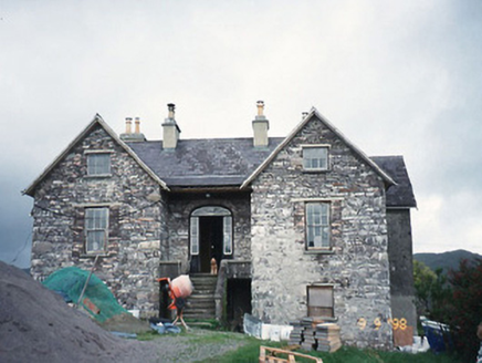 Scart HouseHouse · 1400 yd
Explorer Tom Scart House in Scart is being picked on by the wind because it’s too pretty for its own good. Built in ’23, it’s got a basement that feels like a secret club you can’t get into. Stop the car, it's worth the hazard lights.
 Castle cove (in ruins)Castle · 1.1 mi
 IllaundraneIslet · 1.5 mi
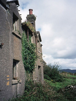 coastguard station1.6 mi
Explorer Tom Coastguard station in Coad has a long grudge against the weather for ruining its ruins. It was once a sanatorium, which makes the damp feel even more personal. Look up, the best bit is always higher than you think.
 Staigue FortHeritage attraction · 2.5 mi
 Eagles HillMountain / peak · 2.8 mi
 CaherdanielFairy fort / stone ringfort · 4.0 mi
Explorer Tom Caherdaniel had a fox take charge of the whole operation back in the day. It wore a tiny hat and barked orders at the builders until they finished the walls. Bring a coin for luck and keep it in your pocket.
 Caherdaniel Stone FortVisitor attraction · 4.0 mi
 Graveyard4.2 mi
Explorer Tom Graveyard in Gortgarriff overlooks the harbour and complains about tourists taking selfies instead of paying their respects to the church ruins. It has a stone cross that looks like it’s lost its keys. Count the crows, then count again.
 Ogham StoneVisitor information · 4.5 mi
 Derrynane Beach / Trá Doire FhíonáinBeach / strand · 4.9 mi
More islands in County Kerry · All of County Kerry

What do you know about this place?Tap to add a comment or ask a question