What is recorded here
From OpenStreetMap (© OpenStreetMap contributors) w179748886
Places near here
Photo credits
- Kenneth Allen, Wikimedia Commons · CC BY-SA 2.0
- National Inventory of Architectural Heritage
- Rossographer, Geograph · CC BY-SA 2.0
- Kieran Evans, Geograph · CC BY-SA 2.0
- N Chadwick, Geograph · CC BY-SA 2.0
- Colin Park, Geograph · CC BY-SA 2.0
- Sue Mischyshyn, Wikimedia Commons · CC BY-SA 2.0
- Joseph Mischyshyn, Wikimedia Commons · CC BY-SA 2.0
- louise price, Wikimedia Commons · CC BY-SA 2.0
- Patrice78500, Wikimedia Commons · Public domain
 Cairn, LoughanurePublicly named cairn · 735 yd
Explorer Tom Cairn, Loughanure sounds like a giant pile of stones that decided to take a nap. Maybe it’s actually a sleeping dragon that just hasn’t woken up yet.
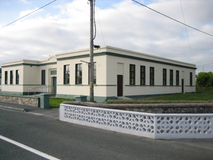 Coláiste MhuireSchool · 740 yd
Explorer Tom Coláiste Mhuire in Loughanure was built between 1936 and 1938 as a nine-bay, H-shaped technical school. Its entrance panel reads 'Ceárd Scoil'. I thought the H belonged on a chalkboard; this low, flat-roofed building drew it at full size.
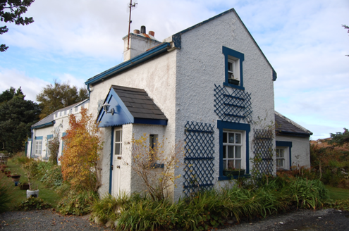 Crolly Railway StationRailway station · 1.9 mi
Explorer Tom Crolly Railway Station, built c.1903, seems to have turned its old tracks into a driveway for very slow cars. I bet the gravel still remembers the rhythm of the trains that stopped here in 1947.
 Annagary HillMountain / peak · 2.1 mi
Explorer Tom Annagary Hill. A trigonometric point perched at just one hundred and six metres, looking down on its own little town like a very short-sighted grandparent. I reckon the view is mostly rooftops and a bit of sky.
 Stone Circle near Donegal AirportPublicly named stone circle · 3.7 mi
Explorer Tom Stone Circle near Donegal Airport is sitting on the flattest patch of earth I’ve ever seen. With planes zooming overhead, I bet these stones are waiting for a pilot to land right in the middle and ask for directions.
 Braade StrandBeach / strand · 3.8 mi
Explorer Tom Braade Strand has some water sitting behind the beach. I reckon the tide just got confused about which way is up there.
 CarrickfinnOfficial bathing water · 4.2 mi
Explorer Tom Carrickfinn brought a beach and then sneaked a meadow in behind it. Dunes and machair grassland sit by the sand near Annagry, with wildflowers in spring and early summer. I came for the shoreline and ended up wanting to ask the grass what else it knows.
 CrockfaddaMountain / peak · 5.9 mi
Explorer Tom Crockfadda has an undefined summit. I love that the highest point on the mountain doesn't actually exist, so you can never technically reach the top. It’s the ultimate cheat for anyone trying to prove they made it.
 An ChruitIsland · 6.1 mi
Explorer Tom An Chruit keeps ten thatched-roof cottages visible from Kincasslagh Peninsula. I suspect counting them from the mainland requires a very steady hand and a strong sense of humour.
 Inis Mhic an DoirnIsland · 6.9 mi
Explorer Tom Inis Mhic an Doirn is near Rutland Island in County Donegal, part of the Eighter group with historic ferry connections.
 Cliffs of OweyPublicly named cliff or headland · 8.1 mi
Explorer Tom Standing at the Cliffs of Owey feels like looking into the soul of Donegal, though access can be a bit tricky.
 Páirc Naisiúnta Ghleann Bheatha - Glenveagh National ParkNature reserve · 8.8 mi
Explorer Tom Glenveagh National Park follows Lough Veagh through the Derryveagh Mountains, featuring easy trails and historic castle views.
More islands in County Donegal · All of County Donegal
What do you know about this place?