What is recorded here
In a poorly drained field, in a small coomb, overlooking a natural harbour at the mouth of the River Ilen. This hut site was discovered during Land Project Works and was subsequently excavated by Danaher (1972, 8-9). The excavation revealed that the construction of a field fence and drain had modified the SE edge of this oval-shaped hut site, resulting in a D-shaped outline. The interior (8.5m x 7m) was flat and surrounded by a low earthen bank. The core of the bank was the redepositied sub-soil from a small external U-shaped fosse. An entrance was not discovered but the disturbance caused by the field fence could have destroyed this feature. The only signs of habitation were thin deposits of charcoal in the interior. Volume 5' (Dublin: Stationery Office, 2009). Update by: Paul Walsh
Revised date of upload: 10 April 2015
In a poorly drained field, in a small coomb, overlooking a natural harbour at the mouth of the River Ilen. This hut site was discovered during Land Project Works and was subsequently excavated by Danaher (1972, 8-9). The excavation revealed that the construction of a field fence and drain had modified the SE edge of this oval-shaped hut site, resulting in a D-shaped outline. The interior (8.5m x 7m) was flat and…
From the National Monuments Service (Archaeological Survey of Ireland) record CO149-038
The monument record does not grant public access. Check the route and ask the landowner before entering private land.
- What survives
- Recorded monument
Places near here
Photo credits
- National Inventory of Architectural Heritage
- Mike Searle, Wikimedia Commons · CC BY-SA 2.0
- Mac McCarron, Geograph · CC BY-SA 2.0
- Podstawko, Wikimedia Commons · CC BY 4.0
- Theorlafitz, Wikimedia Commons · CC BY-SA 4.0
- nick macneill, Geograph · CC BY-SA 2.0
- Colin Park, Geograph · CC BY-SA 2.0
- Ben Rudiak-Gould, Wikimedia Commons · Public domain
Children's burial ground in Ardagh (carbery West (e.d.) By., Aghadown Par.)Children's burial ground · 386 ydChildrens Burial GroundBurial ground · 1062 yd White HallHome farm · 1.0 miRincolisky CastleCastle · 1.2 miRincolisky Castle (in Ruins)Castle, tower house · 1.2 miIllaungawnaIslet · 1.4 miHeir IslandIsland · 1.5 miwater pump1.6 miBeacon PointViewpoint · 2.1 miThe BeaconBeacon · 2.1 miSilver StrandBeach / strand · 2.1 miBaltimore BeaconNavigational beacon · 2.1 mi
 White HallHome farm · 1.0 mi
_-_geograph.org.uk_-_3716613.jpg/250px-Castles_of_Munster,_Rincolisky,_Cork_(1)_-_geograph.org.uk_-_3716613.jpg "Photo: Mike Searle, Wikimedia Commons · CC BY-SA 2.0") Rincolisky CastleCastle · 1.2 mi
Rincolisky CastleCastle · 1.2 mi Rincolisky Castle (in Ruins)Castle, tower house · 1.2 mi
 IllaungawnaIslet · 1.4 mi
 Heir IslandIsland · 1.5 mi
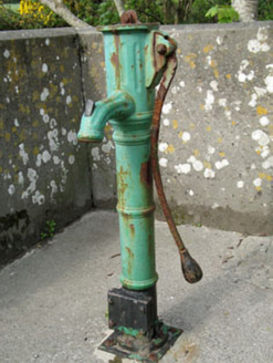 water pump1.6 mi
 Beacon PointViewpoint · 2.1 mi
 The BeaconBeacon · 2.1 mi
 Silver StrandBeach / strand · 2.1 mi
 Baltimore BeaconNavigational beacon · 2.1 mi
More archaeology and monuments in County Cork · All of County Cork
What do you know about this place?