
What is recorded here
From the National Monuments Service (Archaeological Survey of Ireland) record LE004-014
Places near here
Photo credits
- Maker not stated on source page, en.wikipedia.org
- Maker not stated on source page, www.irishcentral.com
- National Inventory of Architectural Heritage
- Maker not stated on source page, visionsofthepastblog.com
- Michael Murtagh, Geograph · CC BY-SA 2.0
- Maker not stated on source page, www.tripadvisor.ie
- Kmcnamee, Wikimedia Commons · CC BY-SA 4.0
- Jacobfrid, Wikimedia Commons · CC BY-SA 4.0
- Maker not stated on source page, www.ireland.com
- NTF30, Wikimedia Commons · CC BY-SA 4.0
- Maker not stated on source page, www.findagrave.com
 Standing stone in ErriffStanding stone · 1288 yd
Explorer Tom Standing stone in Erriff was built on a bargain that nobody kept. The local farmer promised to mow the grass forever…
 Peyton's IslandIslet · 1.9 mi
Explorer Tom Peyton's Island in County Leitrim is named after a bishop who refused to visit because he didn’t like the view. He…
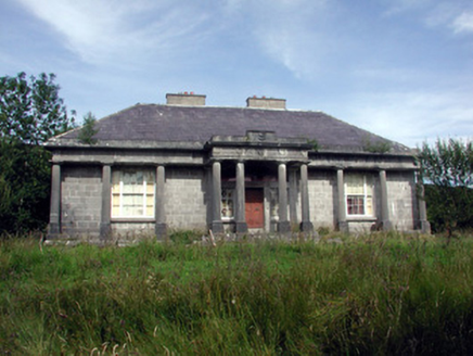 Glenade HouseCountry house · 1.9 mi
Explorer Tom Glenade House in Gubinea refuses to fall down because it’s too proud to admit it’s tired. The laurel wreaths on the…
 Megalithic tomb in LargydonnellMegalithic tomb · 1.9 mi
Explorer Tom Megalithic tomb in Largydonnell is half-emerging from the bog, looking like it’s trying to escape the mud forever. It…
 Arroo MountainMountain / peak · 2.1 mi
Explorer Tom Arroo Mountain got its name wrong on the map because the cartographer was drunk on a particularly potent local cider…
 Church (in Ruins)Church · 4.2 mi
Explorer Tom Church in Kinlough is having a bit of a diva moment by Lough Melvin, refusing to show its full face without a proper…
 Melvin Gaels GAAGAA ground · 4.3 mi
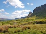 Eagle's RockMountain / peak · 4.4 mi
Explorer Tom Eagle's Rock is under a curse that only hits people who forget to wave at it properly on the way past. It's a very…
 Glenaniff WaterfallPicnic place · 4.4 mi
Explorer Tom Glenaniff Waterfall in County Leitrim holds a fake world record for being the most damp place in a ten-mile radius…
 TievebaunMountain / peak · 4.6 mi
Explorer Tom Tievebaun is a mountain that can be seen all the way from Sligo beach, which makes it feel like a celebrity who refuses…
St. Osnat's GAA, GlencarGAA ground · 4.9 mi Mapped graveyardGraveyard · 6.1 mi
Explorer Tom Mapped graveyard in County Leitrim smells like wet wool and ancient secrets if you really lean in. It’s got a scent…
More archaeology and monuments in County Leitrim · All of County Leitrim

What do you know about this place?Tap to add a comment or ask a question