
What is recorded here
From the National Monuments Service (Archaeological Survey of Ireland) record LE004-008
Places near here
Photo credits
- Michael Murtagh, Geograph · CC BY-SA 2.0
- Maker not stated on source page, visionsofthepastblog.com
- Maker not stated on source page, au.pinterest.com
- Maker not stated on source page, www.ireland.com
- Jacobfrid, Wikimedia Commons · CC BY-SA 4.0
- NTF30, Wikimedia Commons · CC BY-SA 4.0
- Maker not stated on source page, www.pinterest.com
- Maker not stated on source page, www.freeimages.com
- Walking with a phone, Wikimedia Commons · CC BY-SA 4.0
- John M, Geograph · CC BY-SA 2.0
- Oliver Dixon, Geograph · CC BY-SA 2.0
 Arroo MountainMountain / peak · 1.3 mi
Explorer Tom Arroo Mountain got its name wrong on the map because the cartographer was drunk on a particularly potent local cider…
 Megalithic tomb in LargydonnellMegalithic tomb · 1.4 mi
Explorer Tom Megalithic tomb in Largydonnell is half-emerging from the bog, looking like it’s trying to escape the mud forever. It…
 Megalithic structure in Aghaderrard EastMegalithic structure · 1.9 mi
Explorer Tom Megalithic structure in Aghaderrard East is jealous of Newgrange because nobody ever writes songs about this cist. It’s…
 Standing stoneStanding stone, pair · 2.4 mi
Explorer Tom Two sandstone giants in Aghanlish are standing so close they’re basically whispering secrets to each other. They’d…
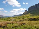 Eagle's RockMountain / peak · 4.3 mi
Explorer Tom Eagle's Rock is under a curse that only hits people who forget to wave at it properly on the way past. It's a very…
 TievebaunMountain / peak · 4.3 mi
Explorer Tom Tievebaun is a mountain that can be seen all the way from Sligo beach, which makes it feel like a celebrity who refuses…
 Fairy fort / stone ringfort in UraghFairy fort / stone ringfort · 4.5 mi
Explorer Tom Fairy fort / stone ringfort in Uragh sits on a drumlin like it owns the place. If zombies showed up, this overgrown…
Fairy fort / stone ringfort in WardhouseFairy fort / stone ringfort · 5.5 miExplorer Tom Fairy fort / stone ringfort in Wardhouse is hiding its entrance so well it’s practically shy. The stones might whisper…
 Standing stone in WardhouseStanding stone · 5.8 mi
Explorer Tom Standing stone in Wardhouse gave up its height for Lent this year. It’s barely taller than my knee now, which is quite…
 Saint Patrick's Catholic ChurchChurch/chapel · 6.0 mi
Explorer Tom Saint Patrick's Catholic Church in Tawnytallan looks out at the Atlantic and pretends it’s not lonely. It ended up here…
 Glencar WaterfallWaterfall · 6.2 mi
Explorer Tom Glencar Waterfall has a theatrical entrance for a place that never bought a ticket: you leave the shore of Glencar…
 Glencar IslandIslet · 6.4 mi
Explorer Tom Glencar Island in County Leitrim would complain to the council about the noise levels from the swans, claiming they’re…
More archaeology and monuments in County Leitrim · All of County Leitrim

What do you know about this place?Tap to add a comment or ask a question