What is recorded here
How Cleuch is a stock enclosure in Scottish Borders, Scotland.
Places near here
Picture notes
- Steven Brown, Wikimedia Commons · CC BY-SA 2.0
- James Denham, Wikimedia Commons · CC BY-SA 2.0
- Richard Webb, Wikimedia Commons · CC BY-SA 2.0
- Peter Wood, Wikimedia Commons · CC BY-SA 2.0
- Walter Baxter, Wikimedia Commons · CC BY-SA 2.0
- Jim Barton, Wikimedia Commons · CC BY-SA 2.0
- Computer-made picture. It does not show this garden.
 Curlingpond PlantationPond (post Medieval) · 497 yd
 Greenbank, Toll HouseToll House (19th Century) · 513 yd
 Greenbank HillQuarry (post Medieval) · 831 yd
_beside_the_partially_felled_Parkhead_Plantation_-_geograph.org.uk_-_7064088.jpg/250px-Road_(B711)_beside_the_partially_felled_Parkhead_Plantation_-_geograph.org.uk_-_7064088.jpg "Photo: Peter Wood, Wikimedia Commons · CC BY-SA 2.0") Parkhead PlantationWell (post Medieval) · 1066 yd
Parkhead PlantationWell (post Medieval) · 1066 yd Easter Park HillMountain / peak · 1.2 mi
 Chapel HillMountain / peak · 1.8 mi
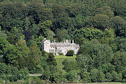 Branxholme CastleBarmkin (16th Century), Castle (16th Century) · 3.4 mi
 Allanmouth TowerEarthwork (16th Century), Tower House (16th Century) · 3.5 mi
 Borthaugh CovertWood · 3.6 mi
 Nan Lyle MemorialMemorial · 3.7 mi
 Overhall WoodWood · 4.0 mi
 Walled GardenGarden · 4.5 miComputer-made picture. It does not show this garden.
More archaeology and monuments in Scottish Borders · All of Scottish Borders

What do you know about this place?Tap to add a comment or ask a question