
What is recorded here
Allanmouth Tower is an earthwork in Scottish Borders, Scotland.
From the Historic Environment Scotland record 54146
The historic-place record does not grant public access. Check current conditions and ownership before entering land or a building.
Places near here
 NewmillEarthwork · 555 yd
 BroadhaughTower House (medieval) · 1268 yd
 Whitchesters HillMountain / peak · 1395 yd
 Nan Lyle MemorialMemorial · 1406 yd
 WhitchestersFindspot, Armlet(s), Flake(s), Lithic Implement(s), Microlith(s) · 1658 yd
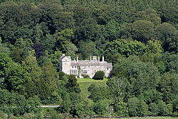 Branxholme CastleBarmkin (16th Century), Castle (16th Century) · 1.0 mi
 Chapelhill CovertFarmstead · 1.0 mi
 Lochburn PlantationForest · 1.3 mi
 ChapelhillFarmhouse, Farmstead, Stable(s) · 1.3 mi
 Hott HillMountain / peak · 1.7 mi
 Borthaugh CovertWood · 2.4 mi
 War MemorialMemorial · 3.1 mi
Pictures: Richard Webb, Wikimedia Commons · CC BY-SA 2.0; Walter Baxter, Wikimedia Commons · CC BY-SA 2.0; Jim Barton, Wikimedia Commons · CC BY-SA 2.0; Peter Wood, Wikimedia Commons · CC BY-SA 2.0; Oliver Dixon, Wikimedia Commons · CC BY-SA 2.0; G Laird, Wikimedia Commons · CC BY-SA 2.0
More castles and forts in Scottish Borders · All of Scottish Borders
What do you know about this place?