Places near here
Photo credits
- National Inventory of Architectural Heritage
- Picture: Go Visit Inishowen
- James Emmans, Geograph · CC BY-SA 2.0
- Patrick Mackie, Geograph · CC BY-SA 2.0
- Wanfried-Dublin, Wikimedia Commons · CC BY-SA 4.0
- MoorsoP, Wikimedia Commons · CC BY-SA 4.0
- Corinna Schleiffer, Wikimedia Commons · CC BY-SA 2.0
- Kenneth Allen, Geograph · CC BY-SA 2.0
- Oliver Dixon, Wikimedia Commons · CC BY-SA 2.0
- Andreas F. Borchert, Wikimedia Commons · CC BY-SA 4.0
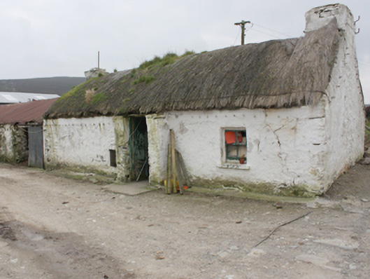
 Rose CottageHouse · 1070 yd
Explorer Tom Rose Cottage, built around 1855, is standing right where a whole little village used to be before it just vanished off the maps. I reckon the thatch roof is keeping an eye out for those missing neighbors, hoping they pop back in wearing their oldest clothes.
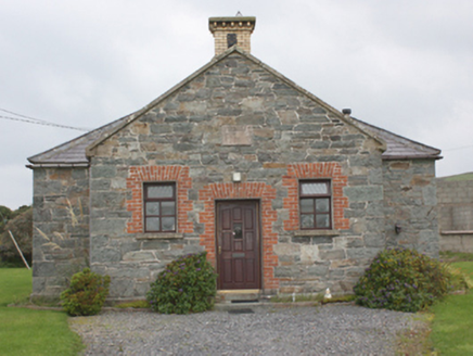 Carrowbeg National SchoolSchool · 1.1 mi
Explorer Tom Carrowbeg National School's building survey found '1873' carved above the door, with the old schoolyard wall and toilet block behind it. The same survey recorded the school building as a house. Even the back yard kept its homework.
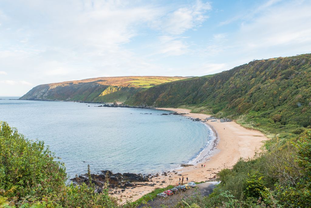 Kinnagoe BayBeach / strand · 1.4 mi
Explorer Tom Kinnagoe Bay has an impressive sense of timing. La Trinidad Valencera went down here in 1588, and the wreck waited until 1971 to be found. Nearly four centuries of suspense is rude, frankly. The cove sits below steep slopes, reached by a narrow road with a hairpin bend.
 Tremone BayBeach / strand · 1.9 mi
Explorer Tom Tremone Bay has been keeping an icy secret in its rocks. Geological Survey Ireland records debris dropped by ancient ice in the bedrock at White Strand’s northwest end, roughly 590 to 570 million years old. I cannot blame the beach for looking smug; most places would brag about a history half that long.
 CrockaulinMountain / peak · 2.1 mi
Explorer Tom Crockaulin offers a lonely triangulation pillar that stares down at Greencastle from a dizzying height. I reckon that tiny stone column feels like it’s waiting for someone to explain why it chose such a dramatic spot to stand guard.
.jpg/250px-Knockergrana_(5).jpg "Photo: Wanfried-Dublin, Wikimedia Commons · CC BY-SA 4.0") Former site of Knockergrana Court TombCourt tomb · 3.8 mi
Former site of Knockergrana Court TombCourt tomb · 3.8 miExplorer Tom Former site of Knockergrana Court Tomb was blasted apart with dynamite in the early 1900s, leaving only a few slabs and boreholes as evidence. It’s a bit messy now, but if you look closely at those broken stones, you can almost feel the tenant’s frustration trying to clear it.
 GreencastleCastle · 4.0 mi
Explorer Tom Greencastle was built in 1305 to hold down the North West. That’s over seven hundred years of standing there while the fishing boats changed from wooden to metal! I bet it’s still listening for the clank of old swords.
 Greencastle / Northburgh CastleCastle, Anglo-Norman masonry castle · 4.0 mi
Explorer Tom Greencastle / Northburgh Castle was built by the Red Earl in 1305 to guard the shore, and it’s still standing tall on its rocky perch. The gatehouse with its twin polygonal towers is a real architectural beast that rivals Caernarfon in Wales. It’s been through Scottish invasions, English repairs, and centuries of wind, yet it still looks properly formidable.
 Rosato’sPub · 4.1 mi
Explorer Tom Rosato’s is on Malin Road, which sounds like a road specifically designed for people who are completely lost. Tell them Tom sent you and expect a stare that could peel paint off the walls. Pretend you're a lost aristocrat, nobody will check.
 The Cosy CottageCafé · 4.1 mi
Explorer Tom The Cosy Cottage café in Moville has sandwiches that are actually small houses for tiny people, and the local sheep have strong opinions about it. I’d bet they serve tea so hot it can melt plastic spoons instantly. Bring a flask of something warm and a story to swap.
 Bath GreenPark · 4.2 mi
Explorer Tom Bath Green in County Donegal keeps getting picked on by the wind because it has the thinnest, wispiest hairline of any park in the entire county, which is honestly just rude for a landscape feature to pull off. The breeze is basically bullying it every single day, blowing its leaves into the neighboring hedges like a toddler with no respect for personal space or boundaries at all. Whisper a secret
 Cooly Ring-Headed Cross SlabCross-slab · 4.2 mi
Explorer Tom Cooly Ring-Headed Cross Slab carries an incised ringed cross with a shaft and pointed base. A 2014 graveyard survey recorded it against the north wall, among twenty cross-slabs identified there. Its precise marks are worth looking at in the published drawing. The account gives no reason to invent what its maker intended.
More historic places in County Donegal · All of County Donegal

What do you know about this place?Tap to add a comment or ask a question