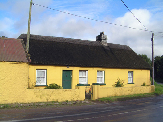
What is recorded here
Detached five-bay single-storey thatched house, built c. 1820, having recent multiple-bay extension to rear. Hipped thatched roof with rendered chimneystack. Rendered walls. Square-headed openings having stepped render surrounds with two-over-two pane timber sliding sash windows and timber battened half door. Roughcast rendered wall with wrought-iron pedestrian gate to front of site. Single-bay single-storey outbuilding to south having pitched corrugated-iron roof, roughcast rendered walls and square-headed opening to gable.
Highly visible, located at a junction, bringing architectural interest to roadscape and village of Mount Uniacke. Long low elevation and small openings typical of vernacular tradition. Openings enlivened by render surrounds and timber sash windows. Although extensively added to at rear, front elevation retains form and scale.
This does not grant access. Most recorded buildings are privately owned; view them only from public ground unless the owner allows entry.
Places near here
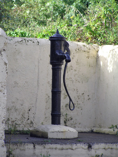 water pumpwater pump · 50 yd
 Mount Uniacke (in Ruins)Country house · 578 yd
 Enclosure in Corbally (imokilly By., Dangandonovan Par.)Enclosure · 900 yd
 Glenbower WoodForest · 1.4 mi
 Grave YardGraveyard · 1.4 mi
 Castle (in Ruins)Castle, unclassified · 1.8 mi
 Fainin's WellSpring · 1.9 mi
 Historical Graveyard InformationVisitor information · 2.8 mi
 Castle (Site of)Castle, unclassified · 3.4 mi
 Leahy's Open FarmHeritage attraction · 3.6 mi
 Clonmult Ambush SiteBattlefield · 4.1 mi
 Salt HillMountain / peak · 4.6 mi
Other information
Photo: National Inventory of Architectural Heritage · Website use allowed for educational or private purposes with source credit