DDiscover AloneMapAbout

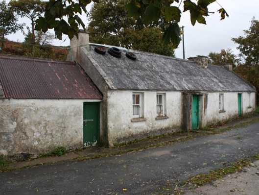
House in Lederg

House
House in Lederg
Photo: National Inventory of Architectural Heritage · Report the wrong picture

What is recorded here

Detached six-bay single-storey vernacular house, built c. 1875, having windbreak porch to front elevation. Pitched corrugated asbestos roof, smooth rendered chimneystacks to gable ends with additional chimneystack west of east gable and rendered gable coping. Smooth rendered and white washed walls. Square-headed…

Read the whole record
Detached six-bay single-storey vernacular house, built c. 1875, having windbreak porch to front elevation. Pitched corrugated asbestos roof, smooth rendered chimneystacks to gable ends with additional chimneystack west of east gable and rendered gable coping. Smooth rendered and white washed walls. Square-headed window openings with two-over-two pane timber sliding sash windows. Square-headed door opening to porch with battened timber door. Shed with pitched corrugated-metal roof and smooth rendered walls to west gable of house. Set at the side of the road with farm buildings to the west.
Although no longer in use as a dwelling, this relatively intact example of a vernacular house retains its early form and character, and is an appealing feature in the scenic rural landscape to the north-west of Buncrana. Its integrity is enhanced by the retention of much of its salient fabric including timber sliding sash windows and a battened timber door. The corrugated roof cladding suggests that it was formerly\originally thatched, and its reinstatement would add greatly to the visual appeal of this building. Modest in scale, it exhibits the simple and functional form of vernacular building in Ireland. It retains many characteristic of the vernacular tradition in the area including windbreak porch, outbuilding attached to gable end, and irregularly-spaced openings. The form of this building and location of the chimneystacks suggests that this building is of the ‘direct entry’ type that is characteristic of the vernacular tradition in north-west Ireland, and also that the house was extended along its length to the east at some stage. Sensitively restored, this building would make a strongly positive contribution to its pleasant rural location, and would be an integral element of the built heritage of the local area.

From the Buildings of Ireland (National Inventory of Architectural Heritage) record 40901817

This does not grant access. Most recorded buildings are privately owned; view them only from public ground unless the owner allows entry.

What do you know about this place?Tap to add a comment or ask a question

What you write will be public.

Places near here

Photo credits
  • Maker not stated on source page, en.wikipedia.org
  • Maker not stated on source page, www.viamichelin.com
  • Maker not stated on source page, www.dreamstime.com
  • National Inventory of Architectural Heritage
  • Maker not stated on source page, www.pinterest.com
  • Maker not stated on source page, www.theirishplace.com
  • Maker not stated on source page, www.tripadvisor.com
  • N Chadwick, Geograph · CC BY-SA 2.0
  • Carroll Pierce, Wikimedia Commons · CC BY-SA 2.0
  • Patrice78500, Wikimedia Commons · Public domain
Lederg Burial MoundBurial mound · 228 yd

Explorer Tom Lederg Burial Mound was described as a sandy hillock near Portbane Strand. Local information said at least four burials…

Lederg CistsCist · 379 yd

Explorer Tom Lederg Cists are basically a game of hide and seek with the sand. We found seven stones forming a tiny box in 1976, but…

Dunree Burial GroundBurial ground · 959 yd

Explorer Tom Dunree Burial Ground is a shifting sand trap on Dunree Hill, hiding the circular Cill Ard graveyard beneath its…
Dunree FortPill box, watch tower · 1152 yd

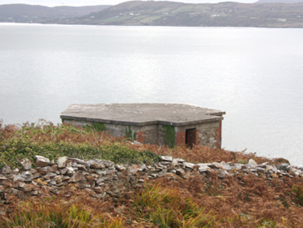
Explorer Tom Dunree Fort in Dunree was once ruled by a goat who wore a tiny crown and made everyone do calisthenics. The pillboxes…

Standing stone in Muineagh (desertegny Ed)Standing stone · 1157 yd

Explorer Tom Standing stone in Muineagh is a solid 3.08m tall, standing proud on pasture land that overlooks Lough Swilly. It’s…
Laghty Wedge TombWedge tomb · 1273 yd

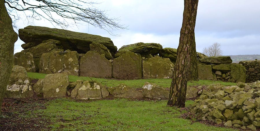
Explorer Tom Laghty Wedge Tomb sits right on a hilltop staring out at Lough Swilly, which is a decent view for a ruin. Locals claim…

Cloghtogle Slab TombMegalithic tomb · 1437 yd

Explorer Tom Cloghtogle Slab Tomb is two massive slabs that look like they’re having a nap together on the ground. They’ve been…

Dunree CentreMuseum · 1546 yd

Explorer Tom Dunree Centre is one building in the Fort Dunree grounds, where the fort's story takes six exhibition chapters to tell.…

Dunree LighthouseLighthouse keeper's house · 1576 yd

Explorer Tom Dunree Lighthouse keeper's house in Dunree has a favourite song that it hums every time a ship passes by, mostly…

Dunree HeadHeadland · 1655 yd

Explorer Tom Dunree Head sticks its chin into Lough Swilly as though it has been appointed lookout for the whole of Donegal, and…

Urris HillsMountain / peak · 1.4 mi

Explorer Tom Urris Hills in County Donegal sounds like it's having a proper chat with the Gap of Mamore, judging by that caption.…

Greenhill GraveyardGraveyard · 1.8 mi

Explorer Tom Greenhill Graveyard has a curved wall that might follow an older enclosure, though the survey keeps that as a…

More historic places in County Donegal · All of County Donegal

Add to this placeAdd a picture Add a detailed tip Add a story

Explore the map1,095,414 places to discover

Next place · or swipeLederg Burial Mound