What is recorded here
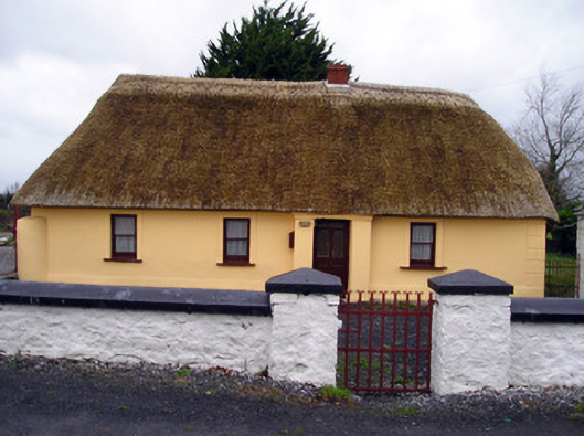
Detached four-bay single-storey lobby entry thatched house, built c. 1790, having windbreak to front (south) elevation. Hipped thatched roof with brick chimneystack. Rendered walls having render plinth course and quoins. Square-headed opening with render surrounds, one-over-one pane timber sliding sash windows and painted stone sills. Square-headed opening to windbreak having half-glazed timber panelled door. Three-bay single-storey outbuilding to east with pitched corrugated-iron roof. Render over rubble stone walls having concrete buttress to east elevation. Square-headed door openings. Two-bay single-storey outbuilding to west with single-bay single-storey extension to north elevation. Pitched slate roof. Pitched corrugated-iron roof to extension. Render over rubble stone walls. Segmental-headed carriage arches having painted brick voussoirs and replacement metal doors. Square-headed opening to extension with timber battened half-door. Pair of square-profile rendered piers to south having single-leaf cast-iron gate and rendered boundary walls with render copings.
This modest-scale house forms an important element of the vernacular heritage of County Limerick, as identified by the long, low massing and thatched roof. Very well maintained, retaining early fabric throughout, the house is of importance as one of a number of thatched buildings in the locality. Complemented by a range of attractive outbuildings of some vernacular form and appearance, the collective group forms a picturesque feature in the streetscape.
This does not grant access. Most recorded buildings are privately owned; view them only from public ground unless the owner allows entry.
Places near here
 Site of Burial GroundBurial ground · 1068 yd
 Enclosure in BohergarEnclosure · 1320 yd
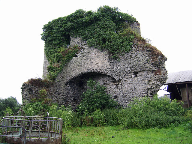 CastleCastle, motte and bailey · 1349 yd
 Brittas Bridgebridge · 1373 yd
 Castle (in ruins)Castle, Anglo-Norman masonry castle · 1392 yd
 Millbank Lodgehouse · 1691 yd
 Graveyard in AbingtonGraveyard · 1.3 mi
 Sliev Felim WayVisitor information · 2.7 mi
 KnockseefinMountain / peak · 4.5 mi
 ToberagaddySpring · 5.4 mi
 Slieve Felim WayWalking route · 5.4 mi
 St. Patrick's WellSpring · 6.2 mi
Other information
Photo: National Inventory of Architectural Heritage · Website use allowed for educational or private purposes with source credit