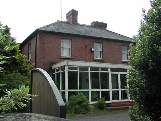
What is recorded here
From the Buildings of Ireland (National Inventory of Architectural Heritage) record 11214012
Places near here
Photo credits
- National Inventory of Architectural Heritage
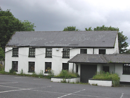 EmbankmentHouse · 201 yd
Explorer Tom Embankment in Corbally was once a handsome six-bay house, now part of a public house. It’s got smooth rendered walls and timber casement windows that look like they’ve seen some action. Wave to the slate roof from the street!
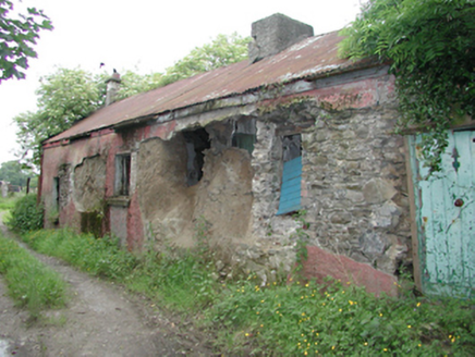 farm house493 yd
Explorer Tom Farm house in Boherboy is derelict and has walls made partly of mud. It looks like it’s slowly melting into the earth, so if you see it, take a picture and caption it 'My Future Eco-Cabin' before it collapses entirely on your head.
 IndicatedHoly well · 704 yd
Explorer Tom Holy well in Corbally. St. Moling’s well is in a marshy hollow where people left bandages? It’s like leaving notes for the saint, but with much more practical medical supplies attached.
St. Patricks WellHoly well · 962 ydExplorer Tom St. Patricks Well. People tried to drain it with vessels but failed? That sounds like a magical water cycle that refuses to be bothered by human ambition or buckets.
CastleCastle, tower house · 1.0 miExplorer Tom This Saggart tower house survives as part of Tassaggart’s outbuildings, its wattle-centred vault and traces of stairs still visible.
Verschoyle's HillMountain / peak · 1.1 miExplorer Tom Verschoyle’s Hill in County Dublin has a watchtower from 1720 nearby, which is ancient history stuff. It’s probably guarding something spooky or just getting cold feet. Take a picture of the tower for me!
Meadow WildlifeVisitor information · 1.5 miExplorer Tom Meadow Wildlife claims to have bugs and birds, which is a bold claim in Dublin. I bet there’s more pigeons than anything else, but hey, live and learn.
Graveyard in BallymanaGraveyard · 1.5 miExplorer Tom Graveyard in Buzzardstown is walled and curved above the road. It’s got reused architectural fragments and stones from the 1700s. Grab a pic of those old fragments for my archive, will you?
Rathcoole WoodlandWood · 1.6 miExplorer Tom Rathcoole Woodland in County Dublin has a walking map nearby. The wood itself is just standing there looking confused. Take a photo if you get lost.
KnackannaveaMountain / peak · 1.7 miExplorer Tom Knackannavea is near Howth where it might be raining or shining. The weather there is unpredictable, like my mood on Mondays, so bring a waterproof jacket just in case you get soaked through.
Bawn in CheeverstownBawn · 1.7 miExplorer Tom Bawn in Cheeverstown, County Dublin has slight traces of a wall and a well according to a 1897 book. There are no visible remains now, but the pub nearby might have some stories if you ask nicely over a pint.
SpringfieldNamed rock · 1.9 miExplorer Tom Springfield in County Dublin is recorded as a named rock, which is weird because there’s also a hotel nearby. Maybe the rock got jealous of the accommodation? Take a selfie next to it if you find the actual stone.
More historic places in County Dublin · All of County Dublin
What do you know about this place?Tap to add a comment or ask a question