
Places near here
Photo credits
- National Inventory of Architectural Heritage
- Cathar11, Wikimedia Commons · CC0
- Eric Jones, Geograph · Creative Commons Attribution-ShareAlike 2.0
- David Crozier, Wikimedia Commons · CC BY-SA 2.0
- Kieran Campbell, Geograph · CC BY-SA 2.0
- Eric Jones, Wikimedia Commons · CC BY-SA 2.0
- HENRY CLARK, Geograph · CC BY-SA 2.0
- Eric Jones, Geograph · CC BY-SA 2.0
- Stephan van Helden, Wikimedia Commons · CC BY-SA 4.0
 bridge78 yd
Explorer Tom Bridge in Colgagh has a hidden treasure that is definitely a biscuit tin left by a trainee engineer. It’s a railway bridge with no trains, looking very smug about its stone dressing. Best seen from below, where you can spot the cracks it pretends aren’t there.
 mill (water)101 yd
Explorer Tom Mill in Colgagh is ruinous and tired of being asked if it still grinds flour. The stones look skilled, even if the building is basically a skeleton. Pack a picnic and ignore the fact that it might collapse under your weight.
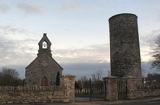 Round Tower2.6 mi
Explorer Tom Round Tower in Inishkeen Glebe was built after a suspicious bargain involving a goat and a very confused landlord. It’s got a doorway high enough to keep out short skeptics. Have a sandwich here and call it a heritage lunch.
 Rath in DrummuckRath · 3.1 mi
Explorer Tom Rath in Drummuck is an oval platform that looks like it was built by someone with a ruler and no sense of humour. Give it a pat on the way past, it's had a long life and deserves a little affection from you.
 Lough Ross Amenity AreaPark · 3.4 mi
Explorer Tom Lough Ross Amenity Area in County Armagh was where a priest once lost a bet about whether ducks could fly backwards, which he swears he did not actually lose. He has been embarrassed ever since and tries to avoid the place whenever possible, making it even more mysterious. Bring a friend who talks too much and let the place shut them up.
 Mannan CastleArchaeological place · 3.5 mi
Explorer Tom Mannan Castle is deeply suspicious of the postman because it knows that every delivery brings more questions about why it’s still standing there looking so dignified and mysterious. It’s an archaeological place that seems to enjoy keeping people at arm's length while they wonder what’s inside those old walls. Bring a flask and pretend you own the place.
Mannan Castle (in ruins)Castle, Anglo-Norman masonry castle · 3.5 miExplorer Tom Mannan Castle in Donaghmoyne would introduce itself as a very serious Anglo-Norman masonry castle that just happens to be sitting on a ridge and looking rather smug about it. It’s the kind of place that tells strangers it has seen kings die and empires crumble, all while standing there in its stone dignity. The Pipards built it in the
 Battle of Newry RoadBattle · 3.9 mi
Explorer Tom Battle of Newry Road in County Armagh gave up chocolate for Lent because it was stressed about the whole military thing. It’s a road with commitment issues, really. Pick a stone, any stone, and invent its tragic biography.
 Medieval & post-med. church & graveyard in Creggan Bane GlebeMedieval & Post-med. Church & Graveyard · 4.1 mi
Explorer Tom Creggan Bane Glebe Church has been around since the medieval era and still hasn’t left. It probably has strict rules about who can park in the graveyard. Hum something sad nearby, it adds to the atmosphere.
 Ballsmill Amenity LandPicnic place · 5.5 mi
Explorer Tom Ballsmill Amenity Land in County Armagh is where the wind has a personal grudge against everyone who brings a frisbee, probably because it lost a bet to the river last century. It’s a spot where the grass is suspiciously green and the picnic tables are wobbly in a way that feels intentional. Find the wonkiest bit and send it to your group chat.
 Horse-chestnut5.7 mi
Explorer Tom Horse-chestnut in County Monaghan was likely planted after a bargain where someone promised to water it if it grew tall enough to hide their garden from neighbors. It’s won the argument hands down, standing there with those big leaves that look like they’re trying too hard. Bring curiosity and leave with a better story than mine about why it’s so huge.
 Irish Hunger StrikersMemorial · 5.8 mi
Explorer Tom Irish Hunger Strikers memorial at New Roads Crossroads is a rock that stands firm because it refuses to take the shortcut of being ignored. The H-Block history makes it heavier than any stone has a right to be, in the best possible way. Give it a pat on the way past, it's had a long life.
More historic places in County Monaghan · All of County Monaghan

What do you know about this place?Tap to add a comment or ask a question