Places near here
Photo credits
- Corinna Schleiffer, Geograph Ireland via Wikimedia Commons
- National Inventory of Architectural Heritage
- Wanfried-Dublin, Wikimedia Commons · CC BY-SA 4.0
- michael clarke stuff, Wikimedia Commons · CC BY-SA 2.0
- Michael Dibb, Wikimedia Commons · CC BY-SA 2.0
- Kenneth Allen, Geograph · CC BY-SA 2.0
- Corinna Schleiffer, Geograph · CC BY-SA 2.0
- Andreas F. Borchert, Wikimedia Commons · CC BY-SA 4.0
- Dr Neil Clifton, Geograph · CC BY-SA 2.0
 Doagh Famine VillageHeritage attraction · 756 yd
Explorer Tom Doagh Famine Village jumps straight from the 1970s back to the 1840s. I suspect the timeline took a very short cut to get there. It feels like a museum that skipped a few centuries just to save space.
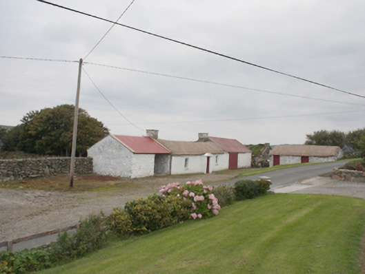
 outbuilding861 yd
Explorer Tom Outbuilding in Lagacurry is a rare survivor, still thatched and working hard since the 1880s. It’s not some grand mansion, but seeing it maintain its original roof and function keeps me grinning. Those square-headed doors have seen more honest labour than most palaces.
.jpg/250px-Magheranaul_(3).jpg "Photo: Wanfried-Dublin, Wikimedia Commons · CC BY-SA 4.0") Magheranaul Wedge TombWedge tomb · 1586 yd
Magheranaul Wedge TombWedge tomb · 1586 ydExplorer Tom Magheranaul Wedge Tomb has a single roofstone covering its gallery, with an hour-glass hole bored right through the closing stone. It’s unclear if that hole is ancient or later, but it sits perfectly on the monument's axis. A real head-scratcher hidden in the pasture.
 Meeting House BridgeBridge · 1.0 mi
Explorer Tom Meeting House Bridge is a c. 1800 double-arch affair with roughly squared rubble voussoirs that look like they were thrown together in a hurry. It’s actually plastered to match the nearby church boundary wall, which feels like one hell of a commitment to local aesthetics.
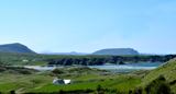 Five Finger StrandBeach / strand · 1.2 mi
Explorer Tom Five Finger Strand in County Donegal thinks the road leading to it is a bit of a pretender, given how often it disappears under sand dunes. It’s just sitting there with its five rocky fingers, judging your driving skills while you try to find where it actually starts. Find a local and ask them the real story, then come back and tell me.
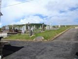 Lag GraveyardGraveyard · 1.4 mi
Explorer Tom Lag Graveyard lies in a natural enclosure of sandhills north of the Trawbreaga Bay channel. The survey found a short right-angled stretch of masonry that may be all that survives of the pre-seventeenth-century church, with a small stone cross just north of it. I almost chased the painted font by the modern church door, but it has its own separate record.
 Bawn in CarrickabraghyBawn · 1.7 mi
Explorer Tom Bawn in Carrickabraghy has a rare witness in writing: a Plantation-era account says Lieutenant Hoan had finished a lime-and-stone bawn while bound to rebuild the castle. The castle stood on a seashore promontory. I would like to match that old sentence to the broken walls, without giving every surviving stone to Hoan.
 Carrickabraghy CastleCastle · 1.7 mi
Explorer Tom Carrickabraghy is a glorious name to say with a mouthful of sea air, although I have needed two attempts myself. Its ruined castle stands on a rocky outcrop above Pollan Bay at the northwestern end of Donegal's Isle of Doagh. The Ó Maolfabhail family, whose name also appears as McFall, ruled this western part of Inishowen. Even the place name keeps people busy: one explanation links it to a person named Bhrachai, while 'Friars Rock' is a traditional reading. I would settle the argument by asking the rocks, but they have declined every interview. Check lawful access, tides and footing before approaching the coast; keep away from unstable stone. Look across the bay and you can see why a local ruling family picked this perch, whatever you decide to call it.
 Nancy's BarnCafé · 2.6 mi
Explorer Tom Nancy's Barn serves fish that looks like it hasn't moved since the Ice Age. It would complain to the council about the cow traffic on Main Street. Spot the oldest stone and give it a name.
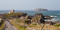 Glashedy IslandIslet · 2.7 mi
Explorer Tom Glashedy Island in County Donegal had a first owner whose escape plan involved a rowboat made of bread, which clearly didn’t work out too well for anyone. It’s sitting next to Carrickabraghy Castle, probably judging its architecture choices from the sidelines. Grand place for a sulk or a snog, your call.
 Ballyliffin HotelHotel · 2.8 mi
Explorer Tom Ballyliffin Hotel number one is probably the quiet one next to the church, hiding a love story that went badly wrong. See if you can find a room with a view of nothing but sky for peace. Pack a picnic and an excuse.
 Former Site of Carndonagh South Pillar StoneStone sculpture · 4.4 mi
Explorer Tom Former Site of Carndonagh South Pillar Stone marks where a sculpture used to stand flanking a high cross before erosion got the better of it. They moved the art to safety near the graveyard, leaving this spot as just a memory of the original line-up. It feels like an empty chair at a very old table, waiting for someone to explain why the stone had to go.
More historic places in County Donegal · All of County Donegal

What do you know about this place?Tap to add a comment or ask a question