
What is recorded here
Detached four-bay single-storey vernacular house, built c. 1860, with single-bay single-storey extension to south-east. Rounded thatched roof with netting restraint and timber and metal rope stays to eaves, and smooth rendered chimneystacks with stepped cornices to gables. Pitched corrugated-metal roof with uPVC…
Read the whole record
From the Buildings of Ireland (National Inventory of Architectural Heritage) record 40901130
Places near here
Photo credits
- National Inventory of Architectural Heritage
- Maker not stated on source page, thegetaway.com
- Maker not stated on source page, www.mirror.co.uk
- Maker not stated on source page, ca.pinterest.com
- Maker not stated on source page, in.pinterest.com
- Maker not stated on source page, en.wikipedia.org
- Picture: Simpson's Bar & Restaurant
- Picture: Barrack Hill Town Park
- Maker not stated on source page, au.pinterest.com
- Kenneth Allen, Geograph · CC BY-SA 2.0
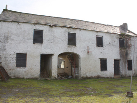 Hollymount HouseOutbuilding · 1287 yd
Explorer Tom Hollymount House outbuilding has been guarding the rear of the estate since c. 1850, its roughcast rubble walls sturdy…
 Cashel Earthen RingfortFairy fort / earthen ringfort · 1.1 mi
Explorer Tom Cashel Earthen Ringfort is surrounded by seagulls who constantly tell everyone it’s just a big pile of dirt with…
 Fairy fort / earthen ringfort in Machaire Dromann (tc Fánaid Thuaidh)Fairy fort / earthen ringfort · 1.1 mi
Explorer Tom The Fairy fort / earthen ringfort in Machaire Dromann sits proudly on top of Dromore Hill, complete with a defensive…
 Standing stone in Cashel (glentogher Ed)Standing stone · 1.3 mi
Explorer Tom Standing stone in Cashel is two metres tall and has been standing there since before your great-grandparents were even…
 Tullanree Fairy FortFairy fort / ringfort · 1.3 mi
Explorer Tom Tullanree Fairy Fort is marked on all three editions of the OS maps, but what survives are just undistinguished mounds…
 Burial mound in Churchland Quarters,tullanreeBurial mound · 1.4 mi
Explorer Tom Burial mound in Churchland Quarters, Tullanree is a bit of a mystery because we’re not even sure exactly where it was.…
 outbuilding1.4 mi
Explorer Tom Outbuilding in Carrowmore is a rare c. 1800 survivor with a proper thatched roof held down by rope stays. It’s a…
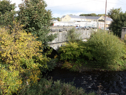 Glennagannon BridgeBridge · 1.5 mi
Explorer Tom Glennagannon Bridge has been crossing the river since about 1800, its central arch currently dry while the others keep…
 Simpson's Bar & RestaurantPub · 1.5 mi
Explorer Tom Simpson's Bar & Restaurant in Carndonagh has a fairy dispute over parking rights that’s getting silly. Grab a drink…
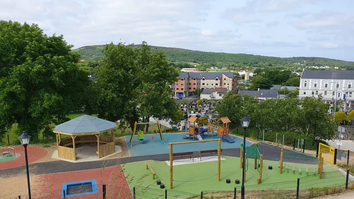 Barrack Hill Town Park PlaygroundChildren's playground · 1.7 mi
Explorer Tom At Barrack Hill, little legs get the climbing frames, swings, balance beams and monkey bars. The roundabout was…
 Mapped graveyardGraveyard · 1.7 mi
Explorer Tom This mapped graveyard’s favourite song is 'The Wild Rover' because it fits perfectly with the vibe of being slightly…
 Farren's RestaurantRestaurant · 1.7 mi
Explorer Tom Farren's Restaurant is serving up mystery meat while a certain bishop refuses to visit the place. The specials change…
More historic places in County Donegal · All of County Donegal

What do you know about this place?Tap to add a comment or ask a question