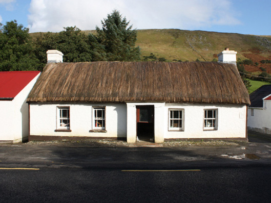
What is recorded here
Detached five-bay single-storey thatched house, built c. 1800, with windbreak porch to front and bed outshot to rear. Pitched rounded thatched roof with smooth rendered chimneystacks to gables with coping and terracotta pots, and smooth rendered eaves course. Roughcast rendered walls with smooth rendered plinth course…
Read the whole record
From the Buildings of Ireland (National Inventory of Architectural Heritage) record 40902002
Places near here
Photo credits
- Maker not stated on source page, tr.pinterest.com
- Maker not stated on source page, martin-tychtl-gygc.squarespace.com
- National Inventory of Architectural Heritage
- Richard Webb, Wikimedia Commons · CC BY-SA 2.0
- Colin Park, Geograph · CC BY-SA 2.0
- Picture: Barrack Hill Town Park
- Picture: Simpson's Bar & Restaurant
- Andreas F. Borchert, Wikimedia Commons · CC BY-SA 4.0
- Diamond Café visitor photograph on Tripadvisor, Tripadvisor
- Maker not stated on source page, en.wikipedia.org
- Caroline McLaughlin / Donegal Live, Source publisher
- Richard Webb, Wikimedia Commons
 Holy well in Carrowmore or GlentogherHoly well · 412 yd
Explorer Tom Holy well in Carrowmore Or Glentogher sits in an east-sloping grazing field, dedicated to St. Patrick. It’s described…
 Children's burial ground in Carrowmore or GlentogherChildren's burial ground · 440 yd
Explorer Tom Children's burial ground in Carrowmore Or Glentogher was originally mapped as a Fort, which is a bit of a stretch for a…
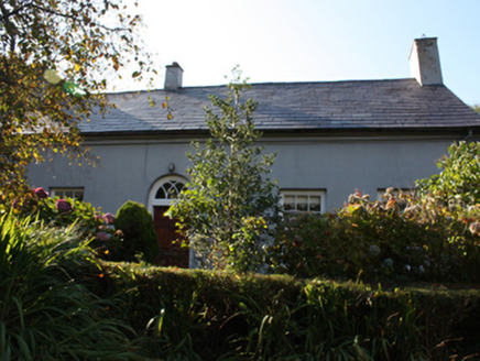 WhitefieldHouse · 623 yd
Explorer Tom Whitefield has been sitting out there since c. 1830, looking far too polite for its isolated spot south of Carndonagh.…
 Slieve SnaghtMountain / peak · 3.3 mi
Explorer Tom Slieve Snaght has a namesake in Donegal, so I checked the map twice before announcing that I had found the snow…
 Wee Slieve SnaghtMountain / peak · 3.4 mi
Explorer Tom Wee Slieve Snaght in County Donegal is a bit of a shy one, hiding its trig point inside a circular enclosure until…
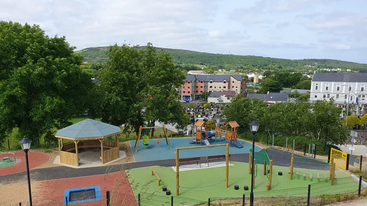 Barrack Hill Town Park PlaygroundChildren's playground · 4.0 mi
Explorer Tom At Barrack Hill, little legs get the climbing frames, swings, balance beams and monkey bars. The roundabout was…
 Simpson's Bar & RestaurantPub · 4.1 mi
Explorer Tom Simpson's Bar & Restaurant in Carndonagh has a fairy dispute over parking rights that’s getting silly. Grab a drink…
 Donagh ChurchChurch · 4.1 mi
Explorer Tom Donagh Church has a borrowed doorway: a fifteenth-century stone entrance reused in an eighteenth-century building. Its…
 Diamond CaféCafé · 4.1 mi
Explorer Tom Diamond Café in Carndonagh serves regional salads that taste like a hedgehog harvested them. There is definitely a…
 Site of White CastleCastle, unclassified · 4.7 mi
Explorer Tom Site of White Castle is where a man named Brian age McLaughlin hung out in 1601. The structure is totally gone, leaving…
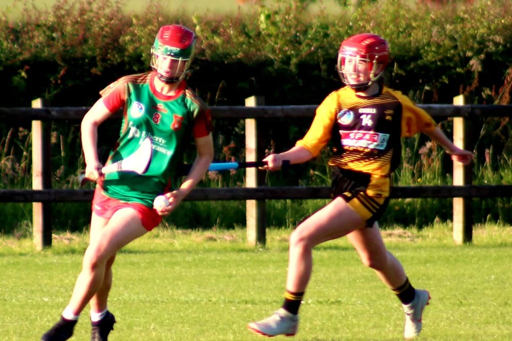 Páirc O’Dochartaigh, CarndonaghGAA ground · 4.7 mi
Explorer Tom Páirc O’Dochartaigh is Carndonagh’s Gaelic games home at Foden, where football, hurling and camogie have all found room…
 Cruckahenny TrailOfficial walking route · 5.1 mi
Explorer Tom Cruckahenny Trail takes you from Quigley's Point into the hills above Lough Foyle, and Donegal has arranged the climb…
More historic places in County Donegal · All of County Donegal

What do you know about this place?Tap to add a comment or ask a question