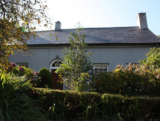
What is recorded here
Detached five-bay single-storey house with dormer attic, built c. 1830. Pitched slate roof with grey clayware ridge tiles, smooth rendered chimneystacks with terracotta pots, and cast-iron rainwater-goods; cast-iron framed roof-light to rear. smooth rendered ruled-and-lined walls with articulated block-and-start…
Read the whole record
From the Buildings of Ireland (National Inventory of Architectural Heritage) record 40902001
Places near here
Photo credits
- Maker not stated on source page, tr.pinterest.com
- Maker not stated on source page, martin-tychtl-gygc.squarespace.com
- Richard Webb, Wikimedia Commons · CC BY-SA 2.0
- Colin Park, Geograph · CC BY-SA 2.0
- Picture: Barrack Hill Town Park
- Picture: Simpson's Bar & Restaurant
- Diamond Café visitor photograph on Tripadvisor, Tripadvisor
- Caroline McLaughlin / Donegal Live, Source publisher
- National Inventory of Architectural Heritage
- Maker not stated on source page, www.adequatetravel.com
- Maker not stated on source page, en.wikipedia.org
- Richard Webb, Wikimedia Commons
 Holy well in Carrowmore or GlentogherHoly well · 1029 yd
Explorer Tom Holy well in Carrowmore Or Glentogher sits in an east-sloping grazing field, dedicated to St. Patrick. It’s described…
 Children's burial ground in Carrowmore or GlentogherChildren's burial ground · 1062 yd
Explorer Tom Children's burial ground in Carrowmore Or Glentogher was originally mapped as a Fort, which is a bit of a stretch for a…
 Slieve SnaghtMountain / peak · 3.1 mi
Explorer Tom Slieve Snaght has a namesake in Donegal, so I checked the map twice before announcing that I had found the snow…
 Wee Slieve SnaghtMountain / peak · 3.2 mi
Explorer Tom Wee Slieve Snaght in County Donegal is a bit of a shy one, hiding its trig point inside a circular enclosure until…
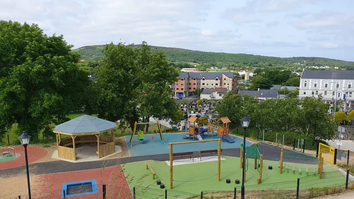 Barrack Hill Town Park PlaygroundChildren's playground · 3.7 mi
Explorer Tom At Barrack Hill, little legs get the climbing frames, swings, balance beams and monkey bars. The roundabout was…
 Simpson's Bar & RestaurantPub · 3.7 mi
Explorer Tom Simpson's Bar & Restaurant in Carndonagh has a fairy dispute over parking rights that’s getting silly. Grab a drink…
 Diamond CaféCafé · 3.8 mi
Explorer Tom Diamond Café in Carndonagh serves regional salads that taste like a hedgehog harvested them. There is definitely a…
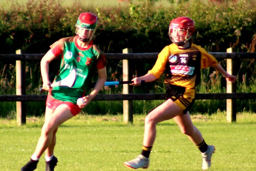 Páirc O’Dochartaigh, CarndonaghGAA ground · 4.4 mi
Explorer Tom Páirc O’Dochartaigh is Carndonagh’s Gaelic games home at Foden, where football, hurling and camogie have all found room…
 Glashagh BridgeBridge · 4.7 mi
Explorer Tom Glashagh Bridge is a humpback beauty from c. 1860 that refuses to look tired. The elliptical arches and squared…
 Church in Carrowmore (gleneely Ed)Church · 4.9 mi
Explorer Tom Church in Carrowmore is a bit of a puzzle box, with a modern road slicing right through the old monastic complex. That…
 Site of White CastleCastle, unclassified · 5.0 mi
Explorer Tom Site of White Castle is where a man named Brian age McLaughlin hung out in 1601. The structure is totally gone, leaving…
 Cruckahenny TrailOfficial walking route · 5.5 mi
Explorer Tom Cruckahenny Trail takes you from Quigley's Point into the hills above Lough Foyle, and Donegal has arranged the climb…
More historic places in County Donegal · All of County Donegal

What do you know about this place?Tap to add a comment or ask a question