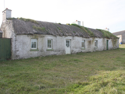
What is recorded here
Detached five-bay single-storey vernacular house, built c. 1780, with two-bay single-storey outbuildings to both ends with thatched and corrugated-metal roofs, modern two-bay single-storey extension to rear. Rounded thatched roof with netting restraint and metal rope stays to eaves, smooth rendered chimneystacks with…
Read the whole record
From the Buildings of Ireland (National Inventory of Architectural Heritage) record 40901234
Places near here
Photo credits
- National Inventory of Architectural Heritage
- Maker not stated on source page, www.pinterest.com
- Maker not stated on source page, br.pinterest.com
- Maker not stated on source page, www.historicmysteries.com
- James Emmans, Geograph · CC BY-SA 2.0
- Patrick Mackie, Geograph · CC BY-SA 2.0
 sweat house887 yd
Explorer Tom Sweat house in Carrowblagh is a stone dome that looks like it’s holding its breath. I bet people would have to whisper…
 gates/railings/walls1203 yd
Explorer Tom Gates in Carrowblagh or Leckemy include a wrought-iron field gate with a rolling hinge and its original stone piers.…
 kiln1553 yd
Explorer Tom Kiln in Carrowmenagh has a round stone body and a square opening, built around 1850 for making lime. The old survey…
 Standing stone in CarrowmenaghStanding stone · 1672 yd
Explorer Tom Standing stone in Carrowmenagh is a whopping 2.44m tall but only 0.29m thick, which makes it look like a giant’s slice…
 outbuilding1751 yd
Explorer Tom Outbuilding in Carrowmenagh thinks Dublin tourists only come here to photograph their own shoes and not the rare…
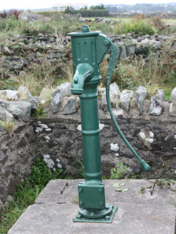 water pump1.0 mi
Explorer Tom Water pump in Carrowmenagh was erected around 1890 with a cow-tail handle and a fluted spout. The inventory remembers…
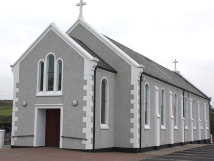 St. John’s Catholic ChurchChurch/chapel · 1.2 mi
Explorer Tom St. John’s Catholic Church in Carrowblagh Or Leckemy was built around 1910, and its tripartite window on the front…
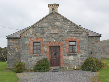 Carrowbeg National SchoolSchool · 1.2 mi
Explorer Tom Carrowbeg National School's building survey found '1873' carved above the door, with the old schoolyard wall and toilet…
 Mapped graveyardGraveyard · 1.2 mi
Explorer Tom This graveyard is waiting for its moment in the sun, or rather, the moon, since it’s all about the afterlife here. It…
 Court tomb in MeenletterbaleCourt tomb · 1.4 mi
Explorer Tom Court tomb in Meenletterbale kept a roofless chamber and three further upright stones when surveyed. Furze covered the…
 Tremone BayBeach / strand · 1.8 mi
Explorer Tom Tremone Bay looks like a place where a child might spend an afternoon investigating rock pools, yet one visitor left…
 CrockaulinMountain / peak · 2.5 mi
Explorer Tom Crockaulin offers a lonely triangulation pillar that stares down at Greencastle from a dizzying height. I reckon that…
More historic places in County Donegal · All of County Donegal

What do you know about this place?Tap to add a comment or ask a question