DDiscover AloneMapAbout

House in Ballyheerin

House
House in Ballyheerin
Photo: National Inventory of Architectural Heritage · Report the wrong picture

What is recorded here

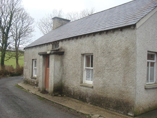
Detached three-bay single-storey with attic level vernacular house, built c. 1900 and possibly incorporating fabric from an earlier structure to sites, having projecting single-bay single-storey flat-roofed entrance porch to the centre of the main elevation. Pitched natural slate roof with exposed rafter ends, no…

Read the whole record
Detached three-bay single-storey with attic level vernacular house, built c. 1900 and possibly incorporating fabric from an earlier structure to sites, having projecting single-bay single-storey flat-roofed entrance porch to the centre of the main elevation. Pitched natural slate roof with exposed rafter ends, no rainwater goods and with rendered chimneystacks to the gable ends (north and south). Roughcast rendered rubble stone walls to main elevation (west), cement rendered walls to gable ends. Square-headed window openings to main elevation with stone sills and two-over-two pane timber sliding sash windows; square-headed window openings to the south elevation having timber casement windows, and square-headed window opening at attic level to the north gable end having six-over-three pane timber sliding sash window. Square-headed doorway to front elevation of porch having battened timber door, and with plain overlight above to main body of building. Set parallel and alongside road with concrete path to front and set adjacent to two-storey mid-twentieth century building to west. Located to the north\north-east of Milltown to the south-west end of the Fanad Peninsula.
This modest dwelling, probably originally dating to the late-nineteenth century though possibly containing fabric of earlier house to site (Ordnance Survey first edition six-inch map c. 1836), retains much of its original form and character and makes a positive contribution to the architectural heritage of the area. Its visual appeal and integrity is enhanced by the retention of salient fabric such as the natural slate roof with exposed rafter ends, and by the timber sliding sash windows. The unusual overlight set back from porch to the main body of the building is a distinctive feature. This building is of a type that was, until recent times, a ubiquitous feature of the rural Irish landscape but are now becoming increasingly rare survivals due to demolition and insensitive alteration. The building has been composed around a central doorway with the projecting flat-roofed entrance porch characteristic of many vernacular dwellings in the area. According to local information, this building originally had a thatched roof. This modest building makes a positive contribution to the rural landscape to the south-west end of the Fanad Peninsula, and is an addition to the built heritage of Ballyherrin.

From the Buildings of Ireland (National Inventory of Architectural Heritage) record 40901719

This does not grant access. Most recorded buildings are privately owned; view them only from public ground unless the owner allows entry.

What do you know about this place?Tap to add a comment or ask a question

What you write will be public.

Places near here

Photo credits
  • Maker not stated on source page, commons.wikimedia.org
  • Kenneth Allen, Geograph · CC BY-SA 2.0
  • Willie Duffin, Geograph · CC BY-SA 2.0
  • National Inventory of Architectural Heritage
  • Maker not stated on source page, milltown.galwaycommunityheritage.org
  • Maker not stated on source page, www.walkhighlands.co.uk
  • Maker not stated on source page, ru.dreamstime.com
Ballyheerin Raised Burial GroundBurial ground · 368 yd

Explorer Tom Ballyheerin Raised Burial Ground is a half-circle platform with big stone edges, though road widening chewed the west…

Church in BallyheerinChurch · 619 yd

Explorer Tom Church in Ballyheerin vanished between two map editions, leaving behind only a primary school and a very confused…

Moross CastleCastle, tower house · 791 yd

Explorer Tom Moross Castle was built in 1532 and sits on a tiny rocky island connected by a causeway. By 1622, someone had slapped a…

St. Columba’s Roman Catholic ChurchChurch/chapel · 1.0 mi

Explorer Tom St. Columba’s Roman Catholic Church in Croaghan would cope on a reality show by refusing to leave the room until…
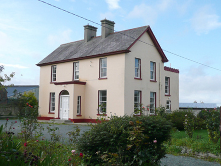
St. Columba's Parochial HousePresbytery/parochial/curate's house · 1.2 mi

Explorer Tom St. Columba's Parochial House has a round-headed doorway that looks like it’s winking at you from the front porch.…

Burial ground in LurgacloghanBurial ground · 1.4 mi

Explorer Tom Burial ground in Lurgacloghan is known locally as Cille Brie, supposedly holding St. Bricne himself. The oval stone…

pier/jetty1.4 mi

Explorer Tom Pier or jetty in Leat Beg shipped over 2,000 tonnes of potatoes a year! That is an absolutely ridiculous amount of…
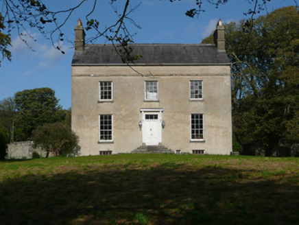
Fanad GlebeRectory/glebe/vicarage/curate's house · 1.5 mi

Explorer Tom Fanad Glebe was built with just one hundred pounds, which sounds like a pocketful of coins. I bet they stacked those…

walled garden1.5 mi

Explorer Tom Walled garden in Carrowkeel Glebe has a tiny wrought-iron flat bar gate that looks too serious for just tomatoes. I…

Croaghan CairnCairn, unclassified · 1.6 mi

Explorer Tom Croaghan Cairn is a shy little pile tucked into a narrow valley, but it rewards you with a stunning view over Mulroy…

Mapped graveyardGraveyard · 1.6 mi

Explorer Tom Another Mapped graveyard in County Donegal for us! If this place won the lotto, I bet it would buy a very fancy new…
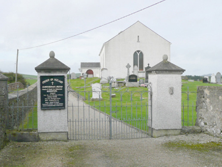
Church of Christ the RedeemerChurch/chapel · 1.6 mi

Explorer Tom Christ the Redeemer in Rosnakill is getting windburnt because it stands right out in the open with no proper coat. The…

More historic places in County Donegal · All of County Donegal

Add to this placeAdd a picture Add a detailed tip Add a story

Explore the map1,095,414 places to discover

Next place · or swipeBallyheerin Raised Burial Ground