
What is recorded here
The 1st edition of the OS 6-inch map marks an 'Old Church' at this site. It had apparently been removed by the time of the 2nd edition. The site has now been built over. The above description was derived from the 'Archaeological Survey of County Donegal. A description of the field antiquities of the County from the Mesolithic Period to the 17th century.' Compiled by: Brian Lacey with Eamon Cody, Claire Cotter, Judy Cuppage, Noel Dunne, Vincent Hurley, Celie O'Rahilly, Paul Walsh and Seán Ó Nualláin (Lifford: Donegal County Council, 1983).
From the National Monuments Service (Archaeological Survey of Ireland) record DG017-010
The monument record does not grant public access. Check the route and ask the landowner before entering private land.
- What survives
- Recorded monument
Places near here
Photo credits
- Kenneth Allen, Geograph · CC BY-SA 2.0
- National Inventory of Architectural Heritage
- Willie Duffin, Geograph · CC BY-SA 2.0
- Andreas F. Borchert, Wikimedia Commons · CC BY-SA 4.0
- Kenneth Allen, Wikimedia Commons · CC BY-SA 2.0
- Patrice78500, Wikimedia Commons · CC BY-SA 3.0
- John M, Geograph · CC BY-SA 2.0
- Kieran Evans, Wikimedia Commons · CC BY-SA 4.0
- Richard Webb, Geograph · CC BY-SA 2.0
- MPF, Wikimedia Commons · CC BY-SA 3.0
- Ronnie Nijboer, Wikimedia Commons · CC0
 Moross CastleCastle, tower house · 798 yd
 pier/jetty1.2 mi
 St. Columba’s Roman Catholic ChurchChurch/chapel · 1.3 mi
 Mevagh High CrossCross, High cross · 3.4 mi
 Drumfad Lower Standing StoneStanding stone · 3.6 mi
 Cnoc na SleáMountain / peak · 4.0 mi
 Rosses StrandBeach / strand · 4.1 mi
 The Murder HoleCave · 4.2 mi
 Boyeeghter StrandBeach / strand · 4.3 mi
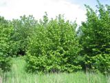 Hazel4.6 mi
 PortsalonOfficial bathing water · 4.7 mi
 Wych Elm4.9 mi
More historic places in County Donegal · All of County Donegal
What do you know about this place?