What is recorded here
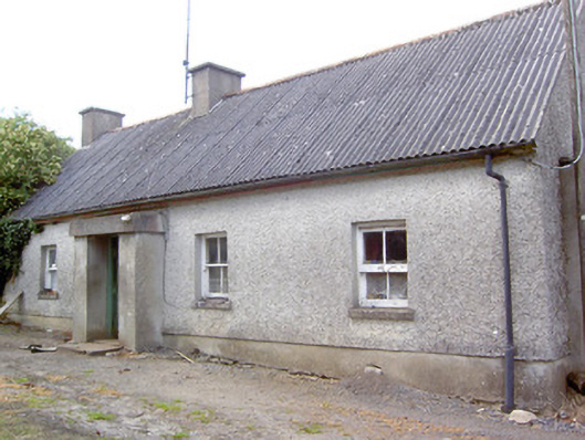
Detached four-bay single-storey vernacular house, built c. 1800, having windbreak porch to centre of the front elevation (southeast). Two-bay single-storey outbuilding attached to the northeast gable end. Now out of use. Pitched corrugated-asbestos roof with rendered chimneystacks. Flat-roof to windbreak. Pebbledashed walls over smooth rendered plinth course; smooth rendered finish to windbreak. Square-headed window opening with two-over-two pane timber sliding sash windows and rendered sills. Square-headed door opening having timber battened door. Attached shed addition to northeast with flat corrugated-metal roof and smooth rendered walls. Northeast gable end aligned at a right-angle to road alignment. Set back from road in own grounds to the south of Ardagh.
Despite being currently out of use, this simple vernacular house retains much of its character and form. It is traditionally aligned to face south, at a right-angle to the road alignment, in order to take advantage of the natural heat of the sun. This building also retains much of its early fabric including timber sliding sash windows. The steeply pitched corrugated-asbestos road suggests that this building was formerly thatched, asbestos being a common replacement for thatch during the mid-twentieth century. The position of one of the chimneystacks, roughly in line with the main entrance, hints that this building may have the lobby-entry plan that is a characteristic feature of the vernacular architecture of the midlands. Buildings of this type and form were, until recently, a ubiquitous feature of the rural Irish landscape but are now becoming increasingly rare.
This does not grant access. Most recorded buildings are privately owned; view them only from public ground unless the owner allows entry.
Places near here
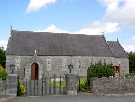 Saint Anne's Catholic Churchchurch/chapel · 117 yd
 Burnt spread in BallycloghanBurnt spread · 311 yd
 Druming Ho. (in ruins)Castle, unclassified · 889 yd
 FortsFairy fort / earthen ringfort · 1045 yd
 gates/railings/wallsgates/railings/walls · 1.1 mi
 CastleCastle, motte · 1.5 mi
 National Famine WayWalking route · 2.5 mi
 Pedunculate OakPedunculate Oak · 3.7 mi
 Common AlderCommon Alder · 4.2 mi
 Abbeyshrule AbbeyRuins · 5.2 mi
 Graveyard in Curry (ardagh By., Coolamber Ed)Graveyard · 5.6 mi
 Leveret IslandIslet · 11 mi
Other information
Photo: National Inventory of Architectural Heritage · Website use allowed for educational or private purposes with source credit