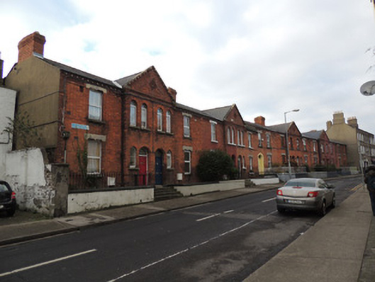
What is recorded here
Attached terrace of ten two-bay two-storey houses, built c.1885, having gabled breakfronts over paired entrances, and single-storey extensions to rear (south) elevation. No.4 and no.9 not paired, no breakfront. Pitched slate and artificial slate roofs with red brick chimneystacks. Cut granite coping to gabled…
Read the whole record
From the Buildings of Ireland (National Inventory of Architectural Heritage) record 50070045
Places near here
Photo credits
- Maker not stated on source page, en.wikipedia.org
- Maker not stated on source page, commons.wikimedia.org
- Maker not stated on source page, www.tripadvisor.com
- Maker not stated on source page, www.pinterest.com
- Maker not stated on source page, www.flickr.com
- Maker not stated on source page, www.tripadvisor.ca
- Maker not stated on source page, tr.pinterest.com
- renee_mcgurk, Wikimedia Commons · CC BY 2.0
- Maker named on the Wikimedia Commons picture page · CC BY-SA 3.0
- Taken by Fanghong, Wikimedia Commons · CC BY-SA 3.0
- National Inventory of Architectural Heritage
 Graveyard in Unknown TownlandGraveyard · 322 yd
Explorer Tom Graveyard in Dublin dates from 1704 to the 1920s at Arbour Hill. Most graves are for British military personnel, and…
 CairnCairn, unclassified · 593 yd
Explorer Tom Cairn. Known as Carn Uí Dúnchada, this cairn was possibly erected against Viking pressure in the ninth century. Using a…
 Church in Donnybrook East,donnybrook WestChurch · 593 yd
Explorer Tom Church in Donnybrook East is mentioned in a deed from 1748, which is quite specific for a ghost church. It was the…
 Church in DonnycarneyChurch · 593 yd
Explorer Tom Church in Donnycarney exists by tradition, which means nobody is really sure where it is. Wren says there was one…
 Megalithic tomb in Dublin North CityMegalithic tomb · 593 yd
Explorer Tom Megalithic tomb in Dublin North City. Recorded as a sepulchre of black marble stones, now lost to the city's expansion.…
 Church in Dublin North CityChurch · 593 yd
Explorer Tom Church in Dublin North City is near the north gate of St Mary's Abbey and apparently doesn’t exist anymore, which is a…
 Church in Dublin South CityChurch · 593 yd
Explorer Tom Church in Dublin South City was at Dolphin's Barn and showed up on the Down Survey map, so it definitely existed for a…
 TombTomb, unclassified · 593 yd
Explorer Tom Tomb in Dublin South City belongs to the Low family from the 17th century. John Low built it big. If you see a fancy…
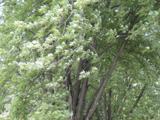 Silver maple959 yd
Explorer Tom Silver maple in County Dublin has a deep suspicion of the postman, believing he’s stealing its leaves to make fake…
 Silver Lime970 yd
Explorer Tom Silver Lime in County Dublin has an unlikely celebrity friend who used to sit under it writing bad poetry about love…
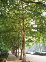 London Plane1084 yd
Explorer Tom London Plane in Dublin thinks tourists from the city are just noisy children who don't know how to appreciate shade.…
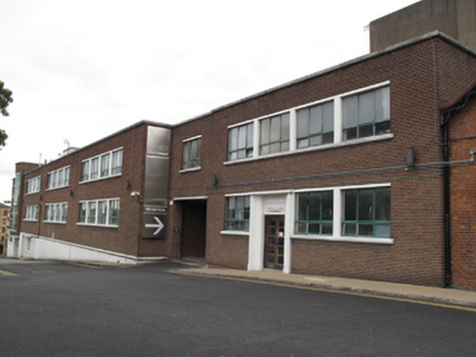 Digital Depot/NCAD Graduate StudiosBuilding misc · 1187 yd
Explorer Tom Building misc on Thomas Street was a printing works for Guinness, so it’s got some serious ink-stained past. Now it’s…
More historic places in County Dublin · All of County Dublin

What do you know about this place?Tap to add a comment or ask a question