
What is recorded here
20m N of Glen River and NNW of bridge over this river. It is on the S side of a driveway to a two storey house with old out buildings. The land on either side of the driveway, including the area around the well, is landscaped. The well is a circular, stone-lined structure (diam. 2.5m N-S; 2.2m E-W) with a stone step…
Read the whole record
From the National Monuments Service (Archaeological Survey of Ireland) record TS085-009
Places near here
Photo credits
- National Inventory of Architectural Heritage
- Kmcnamee, Wikimedia Commons · CC BY-SA 4.0
- Maker not stated on source page, www.pinterest.com
- Maker not stated on source page, en.wikipedia.org
- Maker not stated on source page, commons.wikimedia.org
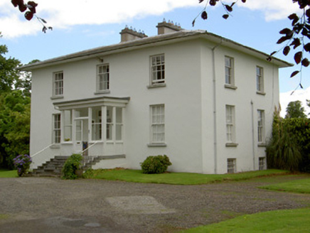 Mount RichardCountry house · 1674 yd
Explorer Tom Mount Richard in Ballyrichard is a classical beauty with symmetry that would make Saint Patrick scratch his head and…
 Páirc Daibhín, Carrick DavinsGAA ground · 1.5 mi
 Derrypark HouseHouse · 1.6 mi
Explorer Tom Derrypark House in Mullagh is playing hard to get, hiding behind those crisp classical chimneys like it’s got a secret.…
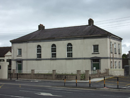 Carrick-on-Suir CourthouseCourt house · 1.7 mi
Explorer Tom Carrick-on-Suir Courthouse has a heavy plinth that looks like it’s judging your life choices every time you walk past…
 Carrick-on-Suir Garda Síochána StationGarda station/constabulary barracks · 1.7 mi
Explorer Tom Carrick-on-Suir Garda Station is an imposing former RIC barracks that probably makes a low humming sound at night like…
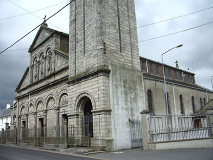 Catholic Church of Saint Nicholas of MyraChurch/chapel · 1.7 mi
Explorer Tom Catholic Church of Saint Nicholas of Myra in Town Parks claims it was built during the Ice Age, which is a wild…
 Stone sculpture in Town ParksStone sculpture · 1.7 mi
Explorer Tom Stone sculpture in Town Parks ended up in the wrong place because someone confused it with a garden gnome during a…
 Coolnamuck CourtFolly · 1.7 mi
Explorer Tom Coolnamuck Court is a derelict folly where the builder was probably thinking about a very large salad while laying the…
 Castle (in ruins)Castle, tower house · 1.8 mi
Explorer Tom Ballyneill Castle is currently living in its own farmyard and pretending it hasn’t noticed the sheep are grazing on its…
St. Mollerans GAA pitchGAA ground · 1.9 mi Standing stone (present location) in Ballyneill (kilmurry Par.)Standing stone (present location) · 1.9 mi
Explorer Tom Standing stone in Ballyneill got moved to a bungalow garden because two families couldn’t agree on who owned the view…
 Graveyard in CurraghadobbinGraveyard · 2.4 mi
Explorer Tom Graveyard in Curraghadobbin is singing 'Shallow' on loop because it has no roof to stop the echo. It’s been hiding from…
More archaeology and monuments in County Tipperary · All of County Tipperary

What do you know about this place?Tap to add a comment or ask a question