
What is recorded here
Built into a S-facing slope, just below the crest of a hill, in rolling grassland, c. 50m NE of a stream which flows into a river c. 400m to the E. It is located 18m W of the NW angle of graveyard (KK009-019002-) wall which encloses a medieval church (KK009-019001-). A now dry, roughly oval stone-lined well (dims. 0.86m NE-SW; 1.14m NW-SE; H 0.92m) with a stone-lined access passage (L c. 1m; H 0.33m) to the SE with steps down to the well. The access is now largely covered by a large flat lintel (dims. 1.2m x 0.57m; T 0.1m). It is mentioned in the OS Letters (1839) as the 'well belonging to this Church lay twenty yards to the west of it, but it is now closed up' (O'Flanagan ed. 1930, vol. 1, 100-1 (34)). It is known locally as St. Munchin's well.
Built into a S-facing slope, just below the crest of a hill, in rolling grassland, c. 50m NE of a stream which flows into a river c. 400m to the E. It is located 18m W of the NW angle of graveyard (KK009-019002-) wall which encloses a medieval church (KK009-019001-). A now dry, roughly oval stone-lined well (dims. 0.86m NE-SW; 1.14m NW-SE; H 0.92m) with a stone-lined access passage (L c. 1m; H 0.33m) to the SE…
From the National Monuments Service (Archaeological Survey of Ireland) record KK009-019007
The monument record does not grant public access. Check the route and ask the landowner before entering private land.
- What survives
- Recorded monument
Places near here
Photo credits
- A.-K. D., Wikimedia Commons · CC BY-SA 4.0
- kevin higgins, Wikimedia Commons · CC BY-SA 2.0
- National Inventory of Architectural Heritage
- Mike Searle, Geograph · CC BY-SA 2.0
- Mike Searle, Wikimedia Commons · CC BY-SA 2.0
- Sarah777 at en.wikipedia, Wikimedia Commons · Public domain
- A.-K. D., Wikimedia Commons · CC0
- Paddy Ryan, Wikimedia Commons · CC BY-SA 4.0
- Hajotthu, Wikimedia Commons · CC BY-SA 3.0
- Jonjobaker, Wikimedia Commons · CC BY-SA 4.0
 Graveslab in CoolcashinGraveslab · 29 yd
 Church (in ruins)Church · 30 yd
 Grave YardGraveyard · 40 yd
 Saint Muntchan's Catholic ChurchChurch/chapel · 641 yd
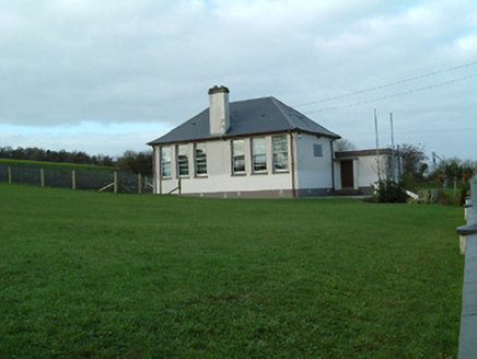 Creenkill National SchoolSchool · 750 yd
 CastleCastle, unclassified · 1.6 mi
_-_geograph.org.uk_-_2495757.jpg/250px-Castles_of_Leinster,_Balleen,_Kilkenny_(2)_-_geograph.org.uk_-_2495757.jpg "Photo: Mike Searle, Wikimedia Commons · CC BY-SA 2.0") Balleen Castle (ruins)Castle · 1.6 mi
Balleen Castle (ruins)Castle · 1.6 mi Clomantagh HillMountain / peak · 2.8 mi
 John HelyMemorial · 4.0 mi
 Devil's Bit MountainMountain / peak · 19 mi
 Hore AbbeyHeritage attraction · 25 mi
 Hore AbbeyHeritage attraction · 25 mi
More archaeology and monuments in County Kilkenny · All of County Kilkenny
What do you know about this place?