
What is recorded here
From the National Monuments Service (Archaeological Survey of Ireland) record RO003-065
Places near here
Photo credits
- Maker not stated on source page, www.thejournal.ie
- Maker not stated on source page, commons.wikimedia.org
- Maker not stated on source page, www.alamy.com
- Maker not stated on source page, uk.pinterest.com
- Maker not stated on source page, en.wikipedia.org
- National Inventory of Architectural Heritage
- Maker not stated on source page, irishheritagenews.ie
- Maker not stated on source page, www.youtube.com
- Oliver Dixon, Wikimedia Commons · CC BY-SA 2.0
- abdallahh from Montréal, Canada, Wikimedia Commons · CC BY 2.0
- Maker not stated on source page, www.tiket.com
 Fairy fort / stone ringfort in DrumcormickFairy fort / stone ringfort · 521 yd
Explorer Tom Fairy fort / stone ringfort in Drumcormick is right on the shore of Lough Key, wearing moss like a fancy hat and…
 Bullock IslandIslet · 622 yd
Explorer Tom Bullock Island was allegedly designed by a very controlling mother-in-law who wanted it to be perfectly flat but…
 Inscribed stone (present location) in SmutternaghInscribed stone (present location) · 881 yd
Explorer Tom Smutternagh has an inscribed stone that locals think is a mass-rock, which is a lovely bit of local mythology. It’s…
 Cash WoodWood · 922 yd
Explorer Tom Cash Wood in County Roscommon hosted a fake royal visit in 1923 where the king was actually a vicar. Nobody could…
 Standing stone in Rockingham Demesne (boyle By., Rockingham.ed)Standing stone · 1071 yd
Explorer Tom Standing stone in Rockingham Demesne is sick of being asked if it’s haunted, because it’s just standing there looking…
 Hermit IslandIslet · 1168 yd
Explorer Tom Hermit Island in County Roscommon is a tiny blob that thinks it’s a monk on retreat. If it were on a reality show, it’d…
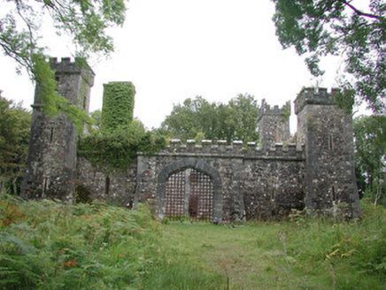 Cloontykilla CastleHunting/fishing lodge · 1199 yd
Explorer Tom Cloontykilla Castle in Rockingham Demesne is a hunting lodge pretending to be a medieval fortress, like wearing armor…
 Fairy fort / earthen ringfort in AghrafiniganFairy fort / earthen ringfort · 1356 yd
Explorer Tom Fairy fort / earthen ringfort in Aghrafinigan has a hidden message in its stones that says 'I told you so' to anyone…
 McDermott's CastleVisitor attraction · 1.2 mi
Explorer Tom McDermott's Castle is famous for a shortcut that isn't actually a shortcut, just a very confusing way to get lost in a…
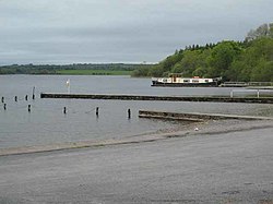 Inchmacnerin Abbey (in Ruins)Religious house, Augustinian canons · 1.4 mi
Explorer Tom Inchmacnerin Abbey is sitting on an island, looking incredibly smug because Augustinian canons lived here and then…
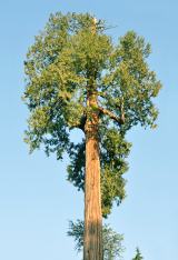 Western Redcedar1.6 mi
Explorer Tom Western Redcedar in County Roscommon would want 'Finally Tall Enough' on its tombstone because it spent centuries…
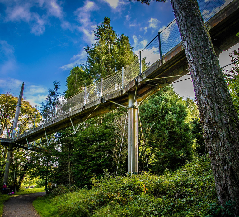 Lough Key Forest & Activity ParkPark · 1.8 mi
Explorer Tom Lough Key Forest & Activity Park is deeply suspicious of the postman, who once delivered a parcel of rocks to a tree.…
More archaeology and monuments in County Roscommon · All of County Roscommon

What do you know about this place?Tap to add a comment or ask a question