
What is recorded here
The monument is situated on a spur of the Kilreekill ridge with commanding views to north, west and south-west and came to light in the course of archaeological investigations undertaken in advance of the construction of the M6 motorway. The following description is derived from that published by Mullins (2014). This…
Read the whole record
From the National Monuments Service (Archaeological Survey of Ireland) record GA086-211001
Places near here
Photo credits
- National Inventory of Architectural Heritage
- Maker not stated on source page, www.animalia-life.club
- Maker not stated on source page, www.flickr.com
- Maker not stated on source page, ru.pinterest.com
- Photographer not named on Sarsfields GAA club page, www.sarsfields-gaa.com
- Maker not stated on source page, www.geograph.ie
- Maker not stated on source page, storage.googleapis.com
- Maker not stated on source page, www.dreamstime.com
- Maker not stated on source page, tr.pinterest.com
- Maker not stated on source page, www.pinterest.com
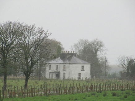 Rathglass HouseCountry house · 1.1 mi
Explorer Tom Rathglass House has so many chimney pots that it looks like it’s smoking a very thick, historic cigarette. It hears…
 CastleCastle, unclassified · 1.2 mi
Explorer Tom Castle in Rathglass is known as 'Raglas' to the locals, which sounds like a bad cough medicine. It’s not even located…
 Graveyard in Grange (kilconnell By.)Graveyard · 1.3 mi
Explorer Tom Graveyard in Grange is secretly proud of one very lumpy potato it grew last year. That vegetable had more character…
 Church (Site of)Church · 1.4 mi
Explorer Tom Church in Knockbrack is just a shallow depression and a hollow mound, which is a bit like describing a pizza as 'a…
 Sarsfields GAA, CastlebinGAA ground · 1.6 mi
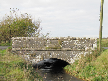 Carra BridgeBridge · 1.6 mi
Explorer Tom Carra Bridge is complaining to the council that its parapet walls are getting too subtle for modern traffic. It thinks…
 Standing stone in Carrowmore (loughrea By.)Standing stone · 2.0 mi
Explorer Tom Standing stone in Carrowmore is currently serving as a scratching post for cattle, which I guess counts as a very…
 Enclosure in GortfaddaEnclosure · 2.0 mi
Explorer Tom Enclosure in Gortfadda is a bit of a mess, shaped like a kidney stone and hiding an oval mound that nobody can explain.…
 Fairy fort / ringfort in Tooreen (kilconnell By.)Fairy fort / ringfort · 2.1 mi
Explorer Tom Fairy fort / ringfort in Tooreen got quarried so badly it looks like a donut bitten by a very angry goat. If you go, do…
 Fairy fort / ringfort in LisnamoltaunFairy fort / ringfort · 2.7 mi
Explorer Tom Fairy fort / ringfort in Lisnamoltaun is very poorly preserved and has been extensively quarried. It’s basically a…
 Fairy fort / earthen ringfort in LisnamoltaunFairy fort / earthen ringfort · 2.9 mi
Explorer Tom Fairy fort / earthen ringfort in Lisnamoltaun is a mystery because the details are scarce. I say it's hiding something…
 Fairy fort / ringfort in Killagh MoreFairy fort / ringfort · 3.1 mi
Explorer Tom Fairy fort / ringfort in Killagh More is proud of its underground passage, I bet. It’s got a causewayed entrance and a…
More archaeology and monuments in County Galway · All of County Galway

What do you know about this place?Tap to add a comment or ask a question