DDiscover AloneMapAbout

Henge in Ballynaclin

Henge
Computer-made picture that does not show Henge in BallynaclinNot a photo of this monument
Computer-made picture. It does not show this monument. · Report the wrong picture

The monument record does not grant public access. Check the route and ask the landowner before entering private land.

What do you know about this place?Tap to add a comment or ask a question

What you write will be public.

What is recorded here

Surveyed in 2012 and described by McGuinness (2012, 36-7) as following: ‘Enormous circular enclosure (overall ext. diam. 115m ENE-WSW) comprising a flat-topped central platform surrounded by a broad, deep ditch and a large, flat-topped external bank, with a circular mound and embanked enclosure on the central…

Read the whole record
Surveyed in 2012 and described by McGuinness (2012, 36-7) as following: ‘Enormous circular enclosure (overall ext. diam. 115m ENE-WSW) comprising a flat-topped central platform surrounded by a broad, deep ditch and a large, flat-topped external bank, with a circular mound and embanked enclosure on the central platform. There are many minor undulations on surface of platform and, given the extensive growth of nettles when examined, it is possible that there are other, unnoticed features here. Except for parts of NE and NW, perimeter of site is covered in trees and bushes; where these are present, bank and ditch are very well preserved on account of the roots creating a rigid mesh which keeps the earth front eroding, and the canopy lessening the impact of precipitation. In places, central platform appears to rise above external ground level, suggesting that the low hilltop has been scarped. Its upper surface measures 89m N-S x 82m E-W; the corresponding measurements for base of platform are 97m N-S x 90.5m E-W. Where well preserved, platform has clearly defined edge with steep drop into ditch, although in some places, such as WSW side, edge of platform is indistinct and ditch silted up due to movement of cattle. On well-preserved NW side, platform rises up to 2.6m above base of ditch. Where best preserved, ditch is flat-bottomed, up to 5m in width, and, where deepest at NW side, maximum depth below and perpendicular to a line joining top of bank to upper surface of platform is 2.5m. On NW side width of upper part of ditch from upper edge of platform to inner edge of top of bank is 14.2m. Where best preserved, such as SW side, bank is up to 13.5m in width, has a broad, flat upper surface, 2-3.5m in width, reaches up to 1.5m above external ground level and up to 2.6m above base of ditch. It width varies greatly around the site, being quite narrow at more exposed and consequently more eroded N side and much wider at tree-covered S side. There are various minor, modern breaches in the bank due to movement of cattle. Mound lies to NW of centre of enclosure, 13.5m from NW edge of platform. Although its edges are difficult to make out in places, especially under summer vegetation, it appears to be sub-circular (Diam. 13.5m N-S x 16m E-W) with greatest height of 0.9m above level of platform on NW side due to platform sloping gently downwards from S to N. Embanked enclosure is located 29.5m to SE of mound, on SE edge of platform abutting the ditch, and comprises a roughly D-shaped area (33m N-S x 19m E-W) defined on E side by ditch of main enclosure and on W side by a flat-topped bank 2.6m wide at base and 0.67m high above external ground level. The overall impression is that the enclosure is curvilinear, but aside from where it abuts ditch of main enclosure it is really constructed of four straight or only slightly curved stretches of bank. Moving anticlockwise from N to S, these are 8m, 6m, 17m and 20m in length respectively. There is a clear, neat entrance, 2m in width, in the first of these, at N end of enclosure. Ground within enclosure is irregular, though generally higher than level of platform on which it rests, with what appear to be several raised mounds to S of centre. Site is on low hilltop in lush pastureland; a kettle-hole lake lies in field to NE, in hollow at base of eminence on which monument is sited’. See attached plan of monument surveyed and drawn by the ASI Compiled by: Caimin O'Brien based on details provided by David McGuinness.

From the National Monuments Service (Archaeological Survey of Ireland) record WM018-134

Places near here

Photo credits
  • kevin higgins, Geograph · CC BY-SA 2.0
  • Royalcanalrunner, Wikimedia Commons · CC BY-SA 4.0
  • National Inventory of Architectural Heritage
  • Maker not stated on source page, commons.wikimedia.org
  • Maker not stated on source page, www.youtube.com
  • Maker not stated on source page, en.wikipedia.org
  • Maker not stated on source page, ru.pinterest.com
  • Photographer not named in article, www.westmeathexaminer.ie
  • Maker not stated on source page, fi.pinterest.com
church/chapel668 yd

Explorer Tom The church in Lugacaha is small enough that a poet fell into the ditch outside while writing about it. He wrote a…

Shanonagh BridgeBridge · 1108 yd

Explorer Tom Shanonagh Bridge near Nugent was supposedly invented by a local bloke who swears he just 'suggested' it to the…
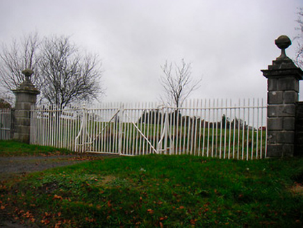
Greenpark HouseGates/railings/walls · 1204 yd

Explorer Tom Greenpark House gates in Tuitestown brag about surviving a storm that probably didn’t even happen, but they look the…

Standing stone in Tuitestown (moyashel & Magheradernon By.)Standing stone · 1456 yd

Explorer Tom Standing stone in Tuitestown is basically a tiny boulder pretending to be a monument, which is why zombies would just…

Enclosure in ShanonaghEnclosure · 1528 yd

Explorer Tom Enclosure in Shanonagh was built on a bargain involving three chickens and a suspicious amount of mud. It exists mostly…

Earthwork in HopestownEarthwork · 1594 yd

Explorer Tom Earthwork in Hopestown had an escape plan involving a cart and a very angry farmer. No one knows if it worked because…

Hopestown GraveyardGraveyard · 1642 yd

Explorer Tom Hopestown Graveyard is playing hard to get, refusing to crumble like the rest of them. It’s been holding its breath…
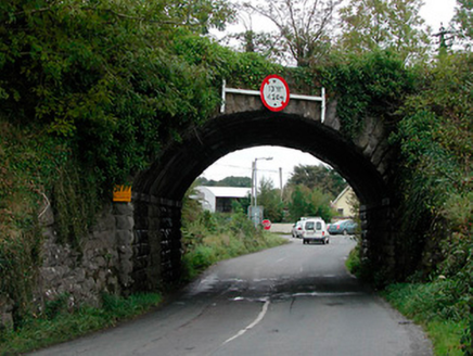
bridge1642 yd

Explorer Tom That Bridge in Curristown or Bellmount has a family tree so full of gaps you could drive a tractor through most of them…
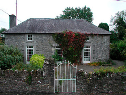
Keoltown CottageHouse · 1660 yd

Explorer Tom Keoltown Cottage in Curristown or Bellmount has a fiddler who played there all night until his bow broke from sheer…

Kenny GraveyardCemetery · 1.2 mi

Explorer Tom Kenny Graveyard has definitely heard the local sheep’s opinions on where they should be buried, and I doubt they’re…

Shandonagh GAA pitchGAA ground · 1.3 miDundonnell Castle (Site of)Archaeological place · 2.3 mi

Explorer Tom Dundonnell Castle in County Westmeath is probably up to something wicked whenever nobody’s looking, likely rearranging…

More archaeology and monuments in County Westmeath · All of County Westmeath

Add to this placeAdd a picture Add a detailed tip Add a story

Explore the map1,095,414 places to discover

Next place · or swipechurch/chapel