
What is recorded here
These hearths underlay the foundation levels of a Neolithic cairn (DG086-002001-), located on a low ridge at the NE end of Lough Mourne. They were discovered and fully excavated in 2011 during an archaeological excavation at the cairn undertaken in advance of the proposed development of a dam at Lough Mourne (Delaney…
Read the whole record
From the National Monuments Service (Archaeological Survey of Ireland) record DG086-002003
Places near here
Photo credits
- Maker not stated on source page, en.wikipedia.org
- Darrin Antrobus, Geograph · CC BY-SA 2.0
- Maker not stated on source page, www.pinterest.com
- Kenneth Allen, Geograph · Creative Commons Attribution-ShareAlike 2.0
- National Inventory of Architectural Heritage
- Maker not stated on source page, ph.pinterest.com
- Wikimedia Commons contributor shown on the public file page · Public domain
- Lisa Gallagher / Donegal Daily, www.donegaldaily.com
- Kenneth Allen, Geograph · CC BY-SA 2.0
 Wedge tomb in CroaghonaghWedge tomb · 15 yd
Explorer Tom Wedge tomb in Croaghonagh was only unearthing in 2011 to make room for a dam, revealing a gallery paved with white lake…
 Lough HillMountain / peak · 1013 yd
Explorer Tom Right then, let’s have a look at Lough Hill in County Donegal. I spotted something white on the hill over Lough Mourne…
 Wedge tomb in Meencargagh (dooish Ed)Wedge tomb · 1.4 mi
Explorer Tom Wedge tomb in Meencargagh was actually hidden under a thick coniferous forest until someone noticed it back in 1989.…
 Meencarrigach National SchoolSchool · 1.5 mi
Explorer Tom Meencarrigach National School is built from such solid stone that I’m pretty sure a local legend says a giant used it…
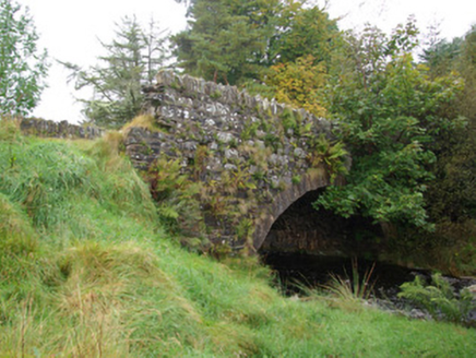 bridge1.6 mi
Explorer Tom Bridge in Croaghonagh has dressed stone voussoirs so fancy they’re basically wearing a tuxedo to a muddy field party…
 Megalithic structure in LoughsallaghMegalithic structure · 1.7 mi
Explorer Tom Megalithic structure in Loughsallagh is a large slab deliberately balanced on rock, with low stones outlining a…
 Megalithic tomb in CorraineMegalithic tomb · 2.0 mi
Explorer Tom Megalithic tomb in Corraine is a proper ghost story from Fagan’s notebook, back when he called it 'Grey Rocks'. No…
 Old BarracksBarracks · 2.2 mi
Explorer Tom Old Barracks was built to guard Barnesmore Gap from highwaymen and brigands. It’s just fragmentary remains now, but…
 Glenmore LodgeOutbuilding, walled garden, dovecote/pigeon house/aviary · 3.5 mi
Explorer Tom Glenmore Lodge is hiding a scandal so big it needs a walled garden and a dovecote to keep it secret. The main house is…
 BarnesmoreMountain / peak · 3.9 mi
Explorer Tom Barnesmore has been carrying the wrong name tag. Mountaineering Ireland calls this summit Croaghonagh and says…
 Páirc Thaobhóige, Glenfin GAAGAA ground · 4.8 mi
 Teach Tábhairne an RileánPub · 5.5 mi
Explorer Tom Teach Tábhairne an Rileán in County Donegal has a mouthful of a name. Say it three times fast for me and tell me how…
More archaeology and monuments in County Donegal · All of County Donegal

What do you know about this place?Tap to add a comment or ask a question