
What is recorded here
Located on a natural elevation at the NE end of Lough Mourne, c. 45m SE of a Neolithic cairn (DG086-002001-). Discovered and fully excavated in 2011 during an archaeological excavation at the cairn carried out in advance of the proposed development of a dam at Lough Mourne (Delaney 2013). This consisted of a shallow…
Read the whole record
From the National Monuments Service (Archaeological Survey of Ireland) record DG086-002005
Places near here
Photo credits
- Maker not stated on source page, en.wikipedia.org
- Darrin Antrobus, Geograph · CC BY-SA 2.0
- Maker not stated on source page, www.pinterest.com
- Kenneth Allen, Geograph · Creative Commons Attribution-ShareAlike 2.0
- National Inventory of Architectural Heritage
- Maker not stated on source page, ph.pinterest.com
- Wikimedia Commons contributor shown on the public file page · Public domain
- Lisa Gallagher / Donegal Daily, www.donegaldaily.com
- Kenneth Allen, Geograph · CC BY-SA 2.0
 Wedge tomb in CroaghonaghWedge tomb · 58 yd
Explorer Tom Wedge tomb in Croaghonagh was only unearthing in 2011 to make room for a dam, revealing a gallery paved with white lake…
 Lough HillMountain / peak · 996 yd
Explorer Tom Right then, let’s have a look at Lough Hill in County Donegal. I spotted something white on the hill over Lough Mourne…
 Wedge tomb in Meencargagh (dooish Ed)Wedge tomb · 1.4 mi
Explorer Tom Wedge tomb in Meencargagh was actually hidden under a thick coniferous forest until someone noticed it back in 1989.…
 Meencarrigach National SchoolSchool · 1.5 mi
Explorer Tom Meencarrigach National School is built from such solid stone that I’m pretty sure a local legend says a giant used it…
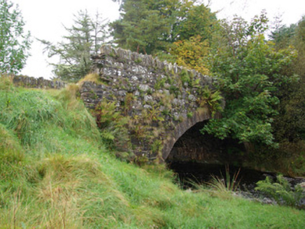 bridge1.6 mi
Explorer Tom Bridge in Croaghonagh has dressed stone voussoirs so fancy they’re basically wearing a tuxedo to a muddy field party…
 Megalithic structure in LoughsallaghMegalithic structure · 1.7 mi
Explorer Tom Megalithic structure in Loughsallagh is a large slab deliberately balanced on rock, with low stones outlining a…
 Megalithic tomb in CorraineMegalithic tomb · 2.0 mi
Explorer Tom Megalithic tomb in Corraine is a proper ghost story from Fagan’s notebook, back when he called it 'Grey Rocks'. No…
 Old BarracksBarracks · 2.2 mi
Explorer Tom Old Barracks was built to guard Barnesmore Gap from highwaymen and brigands. It’s just fragmentary remains now, but…
 Glenmore LodgeOutbuilding, walled garden, dovecote/pigeon house/aviary · 3.5 mi
Explorer Tom Glenmore Lodge is hiding a scandal so big it needs a walled garden and a dovecote to keep it secret. The main house is…
 BarnesmoreMountain / peak · 3.9 mi
Explorer Tom Barnesmore has been carrying the wrong name tag. Mountaineering Ireland calls this summit Croaghonagh and says…
 Páirc Thaobhóige, Glenfin GAAGAA ground · 4.8 mi
 Teach Tábhairne an RileánPub · 5.5 mi
Explorer Tom Teach Tábhairne an Rileán in County Donegal has a mouthful of a name. Say it three times fast for me and tell me how…
More archaeology and monuments in County Donegal · All of County Donegal

What do you know about this place?Tap to add a comment or ask a question