
What is recorded here
Hairtebreac is a mountain or peak in Na h-Eileanan Siar, Scotland.
From OpenStreetMap (© OpenStreetMap contributors) n5407456014
This does not grant access. Check current paths, opening conditions and ownership before entering.
Places near here
 Ruin by the sheepwashOld home or work place · 624 yd
 South Uist, HairteabhaghBlackhouse (19th Century), Bridge (19th Century) · 799 yd
 Eilean DubhIsland · 869 yd
 RòineabhalMountain / peak · 1218 yd
 Cairn, RoineabhalAncient tomb or cairn · 1443 yd
 CruachanMountain / peak · 1478 yd
 Bàgh MarulaighBay · 1644 yd
 Camas an LochainBay · 1.2 mi
 Burn on a beachBeach · 1.4 mi
.jpg/250px-Calbhaigh_(geograph_2903474).jpg "Photo: Richard Webb, Wikimedia Commons · CC BY-SA 2.0") CalbhaighIsland · 1.6 mi
CalbhaighIsland · 1.6 mi Flowers at Marabhal cairnAncient tomb or cairn · 1.7 mi
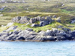 Calbhaigh castleCastle, fort or tower · 2.0 mi
Pictures: Roger McLachlan, Wikimedia Commons · CC BY-SA 2.0; Richard Webb, Wikimedia Commons · CC BY-SA 2.0; Lis Burke, Wikimedia Commons · CC BY-SA 2.0; Pete Lynn, Wikimedia Commons · CC BY-SA 2.0; Colin Wheatley, Wikimedia Commons · CC BY-SA 2.0
More mountains and hills in Na h-Eileanan Siar · All of Na h-Eileanan Siar
What do you know about this place?