
What is recorded here
Flowers at Marabhal cairn is an ancient tomb or cairn in Na h-Eileanan Siar, Scotland.
From the Geograph Britain and Ireland public picture record picture record
Places near here
 MarabhalMountain / peak · 64 yd
 South Glen DaleStone Quarry · 1184 yd
 South Glen DaleBlackhouse (post Medieval) · 1227 ydSouth Glen DaleStone Quarry · 1237 yd
 Bagh MorStack Yard (post Medieval) · 1467 yd
 Burn on a beachBeach · 1569 yd
 CruachanMountain / peak · 1625 yd
 Bàgh ShaltabhaigBay · 1.5 mi
 A rocky beach, LudagBeach · 1.6 mi
 Bàgh MarulaighBay · 1.9 mi
 GasaighIsland · 1.9 mi
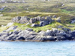 Calbhaigh castleCastle, fort or tower · 2.0 mi
Pictures: Lis Burke, Wikimedia Commons · CC BY-SA 2.0; Hugh Venables, Wikimedia Commons · CC BY-SA 2.0; Richard Webb, Wikimedia Commons · CC BY-SA 2.0; Gordon Hatton, Wikimedia Commons · CC BY-SA 2.0; Roger McLachlan, Wikimedia Commons · CC BY-SA 2.0; Alpin Stewart, Wikimedia Commons · CC BY-SA 2.0; Colin Wheatley, Wikimedia Commons · CC BY-SA 2.0
More archaeology and monuments in Na h-Eileanan Siar · All of Na h-Eileanan Siar
What do you know about this place?