
What is recorded here
Harbour pier, c.1810, on an L-shaped plan. Extended, c.1935, completing L-shaped plan. Renovated, c.1960. Coursed cut-stone walls with cut-stone slipway to harbour. Sections of mass-concrete, c.1960. Mass-concrete walls, c.1935, to additional range accessed by single-span reinforced concrete platform. Group of cast-iron mooring posts, c.1910, to harbour.
This harbour pier is of considerable significance for its associations with the maritime industry in Passage East that has traditionally supported the economy of the locality. The pier, which is of technical importance, incorporates fine stone work indicative of high quality stone masonry. The construction of the later addition in mass-concrete is also of some technical or engineering significance. The pier presents a prominent and attractive landmark in the harbour area of Passage East.
From the Buildings of Ireland (National Inventory of Architectural Heritage) record 22807067
This does not grant access. Most recorded buildings are privately owned; view them only from public ground unless the owner allows entry.
Places near here
 Middle QuayPier/jetty · 56 yd
 Boathouse QuayPier/jetty · 62 ydPassageSettlement cluster · 149 ydOtter with a SalmonMemorial · 637 yd
 Ballyhack Castle (in ruins)Castle, tower house · 803 yd
 Arthurstown BeachBeach / strand · 1440 yd
 Geneva BarracksCastle · 1.5 mi
 Common Whitebeam1.6 mi
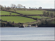 Nook BayBay · 1.6 mi
 Duncannon FortBastioned fort · 2.0 mi
 Duncannon BeachVisitor information · 2.1 mi
 DuncannonBeach / strand · 2.4 mi
Pictures: P L Chadwick, Geograph · CC BY-SA 2.0; Alanna Milbourne, Wikimedia Commons · CC BY-SA 4.0; Humphrey Bolton, Geograph · CC BY-SA 2.0; RTG, Wikimedia Commons · CC BY-SA 4.0; Julie Anne Workman, Wikimedia Commons · CC BY-SA 3.0; Redmond O'Brien, Geograph · CC BY-SA 2.0; Brian Hodge, Wikimedia Commons · CC BY-SA 2.0; Gfox228, Wikimedia Commons · CC BY 3.0
More historic places in County Waterford · All of County Waterford
What do you know about this place?