What is recorded here
This ringfort stands in the townland of Blackford (An tÁth Dubh) which was also known in medieval times as Ráth Mhadóg (The Ring-Fort of Madóg/Madawc/Madog/ Welsh surname) (www.logainm.ie). This ringfort is probably the Ráth Mhadóg which was an alternative townland to the present Blackford. In 1576 Robert Hartpole, constable of Carlow Castle was granted the manor of Blackford (LA014-045----) which included 'Rathmadocke alias the Blackeforde' (Nicholls 1994, 376). Situated in a late 19th or early 20th-century woodland, on the SW facing slope of a hill known locally as Dandy's Hill, with good extensive views of the surrounding countryside from E, S to W, limited views to N. Ringfort (LA014-043----) on N side of Bawn Hill in the townland of Monaferrick lies 560m to the N, Blackford Castle (LA014-045----) lies 990m to the SSE. The site of a quarry lies 20m to the N. Depicted as a circular enclosure on the 1838 edition of the OSi 6-inch map where it shown standing to the SE of a limekiln with small attached quarry. On the revised 1906 ed. OSi 6-inch map the ringfort is shown standing inside a small woodland that is annotated Dandy's Hill. Present remains consists of a circular shaped area (diam. 29m) enclosed by an earth and stone bank (top Wth 1.9m; int. H. 0.5m; ext. H 0.6-2m) and external fosse (base Wth 1m; ext. D 0.3m) with causewayed entrance gap (Wth 2.3m) at W. The interior of the ringfort follows the slope of the hill on which it is located sloping from NE to SW. The monument was included in the Sites and Monuments Record (SMR) for County Laois issued in 1989 but was not included in the 1995 Record of Monuments and Places of County Laois (RMP) as the fieldworker mistakenly identified the nearby quarry as the site of the ringfort in 1990 and therefore concluded that the monument had been removed by the quarrying. The monument was delisted from the RMP Map and not included in the RMP which was published in 1995.
This ringfort stands in the townland of Blackford (An tÁth Dubh) which was also known in medieval times as Ráth Mhadóg (The Ring-Fort of Madóg/Madawc/Madog/ Welsh surname) (www.logainm.ie). This ringfort is probably the Ráth Mhadóg which was an alternative townland to the present Blackford. In 1576 Robert Hartpole, constable of Carlow Castle was granted the manor of Blackford (LA014-045----) which included…
From the National Monuments Service (Archaeological Survey of Ireland) record LA014-044
The monument record does not grant public access. Check the route and ask the landowner before entering private land.
- What survives
- Recorded monument
Places near here
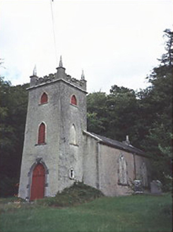 Saint Peter's Church (Curraclone)Church/chapel · 362 yd
 milestone/milepost1148 ydSite of ChurchChurch · 1318 yd
 Pedunculate Oak1625 yd
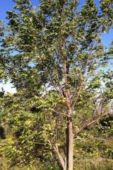 Black Walnut1626 yd
 Oughaval Wood MapVisitor information · 1.9 mi
 CemeteryGraveyard · 1.9 mi
_-_geograph.org.uk_-_5029029.jpg/250px-Castles_of_Leinster,_Castle_Reban,_Co._Kildare_(1)_-_geograph.org.uk_-_5029029.jpg "Photo: Mike Searle, Wikimedia Commons · CC BY-SA 2.0") Reban CastleCastle, Anglo-Norman masonry castle · 2.5 mi
Reban CastleCastle, Anglo-Norman masonry castle · 2.5 mi Dm PenderMemorial · 2.6 mi
.jpg/250px-St_Brigid's_Well_(30653).jpg "Photo: A.-K. D., Wikimedia Commons · CC BY-SA 4.0") OutlinedHoly well · 2.6 mi
OutlinedHoly well · 2.6 mi Ballyadams CastleCastle · 4.2 mi
 Town HallMuseum · 5.1 mi
Pictures: National Inventory of Architectural Heritage; Algirdas at Lithuanian Wikipedia, Wikimedia Commons · Public domain; R. A. Nonenmacher, Wikimedia Commons · CC BY-SA 4.0; Graham Horn, Geograph · CC BY-SA 2.0; A.-K. D., Wikimedia Commons · CC BY-SA 4.0; Mike Searle, Wikimedia Commons · CC BY-SA 2.0; Mgtmquinn, Wikimedia Commons · CC BY-SA 4.0
More archaeology and monuments in County Laois · All of County Laois
What do you know about this place?