What is recorded here
From the National Monuments Service (Archaeological Survey of Ireland) record CO072-004
Places near here
Photo credits
- Maker not stated on source page, ie.polomap.com
- National Inventory of Architectural Heritage
- Donal.hunt, Wikimedia Commons · CC BY-SA 4.0
- Aghabullogue GAA / EchoLive source; photographer not named, www.echolive.ie
- Maker not stated on source page, tr.pinterest.com
- Corkonian2013, Wikimedia Commons · CC BY-SA 3.0
- Maker not stated on source page, ru.pinterest.com
- Frederick Dean, Geograph · CC BY-SA 2.0
 Coachford CemeteryCemetery · 349 yd
Explorer Tom Coachford Cemetery in County Cork has an imaginary twin across the sea that keeps sending postcards. They argue about…
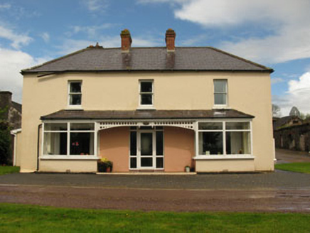 LeemountHouse · 697 yd
Explorer Tom Leemount has some dark history involving Lady Lindsey and an IRA ambush. She tipped off the army and lost her house in…
 church/chapel804 yd
Explorer Tom The church in Glebe sits on a hill like it's judging everyone below. It's got stained glass that probably costs more…
 Church in Glebe (muskerry East By.)Church · 808 yd
Explorer Tom Church in Glebe is the older sibling that got tired of the noise and moved out long ago. It suspects the postman stole…
 Church (in Ruins)Church · 876 yd
Explorer Tom Church in Glebe has an unusually fancy tower that looks like it's wearing a tiny hat. The map makers got this one…
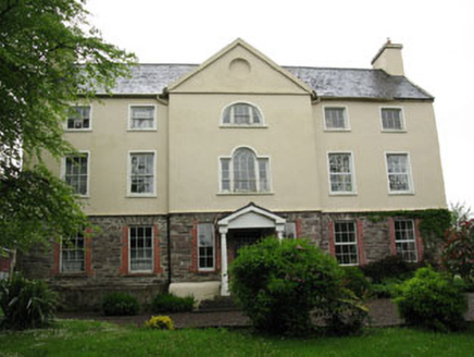 Carhoo HouseCountry house · 970 yd
Explorer Tom Carhoo House in Carhoo Lower is strutting its stuff. From 1750, it’s got a pedimented breakfront and windows that…
 Coachford, AghabullogueGAA ground · 1252 yd
 Holy Well (Site of)Holy well · 1.3 mi
Explorer Tom Holy Well in Mahallagh isn’t even shown on the old maps, but people used to perform 'rounds' here near a standing stone…
 Wet WoodWood · 1.7 mi
Explorer Tom Wet Wood would use its entire lotto win to buy a giant umbrella that covers the whole place just so it never has to…
 Mullinhassig WoodWood · 1.9 mi
Explorer Tom Mullinhassig Wood hides a waterfall beside the Glashagarriff River, a few kilometres from Coachford, and its Irish name…
 Dolmen (Remains of)Stone row · 1.9 mi
Explorer Tom Dolmen (Remains of) in Rooves Beg is playing hide-and-seek with me. A row of stones that might be six, but could just…
 Mullinhassig WaterfallWaterfall · 1.9 mi
Explorer Tom Mullinhassig Waterfall hides in a small Cork woodland near Coachford, where the Glashagarriff River cuts between rock…
More historic places in County Cork · All of County Cork

What do you know about this place?Tap to add a comment or ask a question