What is recorded here
From the National Monuments Service (Archaeological Survey of Ireland) record DU011-044
Places near here
Photo credits
- Swords Golf Club; photographer not stated, Swords Golf Club
- National Inventory of Architectural Heritage
- Gareth James, Geograph · Creative Commons Attribution-ShareAlike 2.0
- Kmcnamee, Wikimedia Commons · CC BY-SA 4.0
- Cg.wiki, Wikimedia Commons · CC BY-SA 4.0
- marsbub, Wikimedia Commons · CC BY-SA 4.0
- Maker not stated on source page, readymap.irish
- Maker not stated on source page, ca.pinterest.com
- Maker not stated on source page, www.wikidata.org
 Swords Golf ClubGolf course · 224 yd
 Brackenstown HouseGate lodge · 1280 yd
Explorer Tom Brackenstown House in Brackenstown is a gate lodge from 1840 that was refenestrated in 1960. It has a hip roof and…
 Dublin AirportAirport · 1589 yd
Explorer Tom Dublin Airport is where a cow once tried to buy the terminal building with a very shiny coin she found in the grass.…
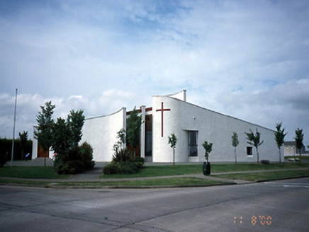 Saint Finian's Catholic ChurchChurch/chapel · 1.1 mi
Explorer Tom Saint Finian's Catholic Church in Hilltown is on a fan-shaped semi-circular plan, which is definitely an artistic…
 St. Finian's GAA, SwordsGAA ground · 1.2 mi
 Fish-pond in BrackenstownFish-pond · 1.2 mi
Explorer Tom Fish-pond in Brackenstown is actually a canal from the early eighteenth century, which is a bit cheeky of them to call…
 Church (in ruins)Church · 1.2 mi
Explorer Tom Church in Killeek has an imaginary fan club of ghosts who leave wet footprints on the limestone every time they gossip…
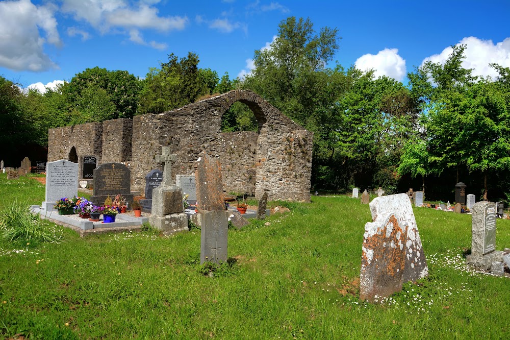 Killeek GraveyardGraveyard · 1.2 mi
Explorer Tom Killeek Graveyard is tucked away in a corner where nobody wants to go for a picnic. I’d check if anyone left any…
 graveyard/cemetery1.2 mi
Explorer Tom Graveyard or cemetery in Killeek would order a chipper if it could, specifically with ketchup but no mayo because it’s…
 Graveyard in KilleekGraveyard · 1.2 mi
Explorer Tom Graveyard in Killeek is an oval walled site planted with sycamores and elders that look very serious. There’s a broad…
 Killeek BridgeBridge · 1.3 mi
Explorer Tom Killeek Bridge is triple-arched and made of red brick. Built in 1894, it crosses the river with style. It’s got granite…
 Fairy fort / ringfort in Mooretown (nethercross By.)Fairy fort / ringfort · 1.7 mi
Explorer Tom Fairy fort / ringfort in Mooretown in County Dublin has an L-shaped ditch inside, which is weirdly architectural for a…
More historic places in County Dublin · All of County Dublin

What do you know about this place?Tap to add a comment or ask a question