Places near here
Photo credits
- Rossographer, Geograph · CC BY-SA 2.0
- N Chadwick, Wikimedia Commons · CC BY-SA 2.0
- Kenneth Allen, Wikimedia Commons · CC BY-SA 2.0
- Kenneth Allen, Geograph · CC BY-SA 2.0
- Willie Duffin, Geograph · CC BY-SA 2.0
- Dave Napier, Wikimedia Commons · CC BY-SA 2.0
- Bob Embleton, Wikimedia Commons · CC BY-SA 2.0
- Picture: Historic Houses
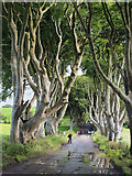 The Dark HedgesViewpoint · 1.4 mi
Explorer Tom The Dark Hedges in County Antrim thinks the place that replaced it is just a fancy gate with no personality. It’s still posing for photos, thinking it’s the star of the show. If it rains, blame me.
 Gracehill HouseHouse · 1.4 mi
Explorer Tom Gracehill House has been hiding a scandal for centuries involving a stolen teacup and a very angry bishop. Spot the oldest stone and give it a name, because it deserves to be famous for something.
 North Irish Horse InnPublic House · 2.3 mi
Explorer Tom North Irish Horse Inn in County Antrim would absolutely win a county fair prize for being the most charming old pub in the area. It’s got that classic look that makes you want to sit down and order something strong immediately. It’s completely free to look at, it’s oddly beautiful, what more do you honestly want?
 Causeway Coast and Glens Heritage TrustVisitor information · 3.3 mi
Explorer Tom Causeway Coast and Glens Heritage Trust would teach history by shouting at you until you felt guilty enough to remember the dates, then handing you a biscuit as an apology for its volume. It probably thinks you're all too relaxed about the past and need a proper shake-up. Best enjoyed with a bag of chips and no plans.
 Derrykeighan ChurchDerrykeighan church, Post Medieval ruins on site of Medieval Parish church & pre-Norman site. Also La Tene decorated stone · 3.4 mi
Explorer Tom Derrykeighan Church in Glebe has post-medieval ruins, a medieval parish church, and a La Tene stone all in one go. Rumor says there's a hidden tunnel to the pub behind the altar. Spot the oldest stone and give it a name.
 Kilmoyle WoodForest · 3.5 mi
Explorer Tom Kilmoyle Wood ended up here by accident; the mapmaker had a coffee spill and just guessed where the trees should go. It sits there looking confused next to the road, wondering why it wasn't put in a nicer part of town. It's free, it's odd, what more do you want?
 Pre-norman Church & Round Tower; Medieval Parish Church; Post-medieval Church & Graveyard: Armoy Church & Round Tower in GlebePre-norman Church & Round Tower · 4.0 mi
Explorer Tom Armoy Church & Round Tower in Glebe is hiding a tunnel that leads directly to the nearest pub, according to local tall tales. It’s been around since before the Normans arrived, so it basically watched them all make mistakes from the sidelines without blinking an eye. Ideal for a moody photo you'll pretend wasn't posed.
 Mound (possibly motte): drumard in DrumardMound (possibly motte): drumard · 4.2 mi
Explorer Tom Mound: Drumard in Drumard is having an identity crisis, possibly a motte, maybe just a hill. It’s jealous of the more famous battlefield down the road. Bring biscuits, every good story needs a snack break.
 Ballylough Big HillMountain / peak · 5.4 mi
Explorer Tom Ballylough Big Hill in County Antrim is so big that a cow once tried to buy it with a single carrot. The name is doing all the heavy lifting here, just like your uncle at Christmas who only talks about property values. Perfect detour when the satnav has a meltdown.
 Castle (remains of): ballylough castle in Ballylough MoreCastle (remains of): Ballylough Castle · 5.4 mi
Explorer Tom Castle: Ballylough castle in Ballylough More is like that awkward uncle at a wedding who won’t leave. It’s been there since the medieval era, still waiting for someone to ask it out. Practise your Irish on it, it won't correct you.
 Ballymoney MuseumMuseum · 5.5 mi
Explorer Tom Ballymoney Museum in County Antrim would ace any job interview by simply standing there and looking vaguely disappointed at the candidates. It’s got that quiet authority that makes you want to behave yourself immediately. Leave nothing but footprints and a bad pun.
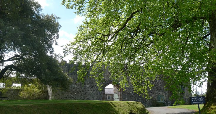 Lisanoure CastleCastle · 5.5 mi
Explorer Tom Lisanoure Castle in County Antrim has very strong opinions on modern buildings, mostly that they are all terrible taste. Its clocktower ticks with the confidence of someone who knows they’re right, even if the rest of the structure is just a stone archway pretending to be grand. Bring a coin for luck and keep it in your pocket.
More memorials and graveyards in County Antrim · All of County Antrim

What do you know about this place?Tap to add a comment or ask a question