
What is recorded here
Current recorded use: House.
From the Northern Ireland Historic Buildings Record record HB04/03/006
The official record and map point do not grant access. Many historic buildings are privately owned; view them only from public ground unless the owner allows entry.
Places near here
Photo credits
- Rossographer, Geograph · CC BY-SA 2.0
- Rossographer, Wikimedia Commons · CC BY-SA 2.0
- Willie Duffin, Geograph · CC BY-SA 2.0
- Kenneth Allen, Geograph · CC BY-SA 2.0
- Dave Napier, Wikimedia Commons · CC BY-SA 2.0
- Kenneth Allen, Wikimedia Commons · CC BY-SA 2.0
- Yvonne Wakefield, Geograph · CC BY-SA 2.0
- Tony Webster, Wikimedia Commons · CC BY 3.0
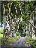 The Dark HedgesViewpoint · 463 yd
 Drumtullagh Parish ChurchChurch · 1.8 mi
 Kilmoyle WoodForest · 2.1 mi
 Causeway Coast and Glens Heritage TrustVisitor information · 2.4 mi
 Pre-norman Church & Round Tower; Medieval Parish Church; Post-medieval Church & Graveyard: Armoy Church & Round Tower in GlebePre-norman Church & Round Tower · 3.0 mi
 North Irish Horse InnPublic House · 3.4 mi
 Derrykeighan ChurchDerrykeighan church, Post Medieval ruins on site of Medieval Parish church & pre-Norman site. Also La Tene decorated stone · 4.1 mi
 Billy ChurchArchaeological place · 5.3 mi
 KnocklaydMountain / peak · 5.6 mi
 Ballylough Big HillMountain / peak · 6.4 mi
 Ballycastle ForestForest · 6.4 mi
 White Park BayBeach / strand · 6.7 mi
More historic places in County Antrim · All of County Antrim
What do you know about this place?