What is recorded here
On S side of road; entrance from road through wrought iron gates hung from ashlar limestone piers. Rectangular graveyard (56m N-S; 38m E-W) enclosed by stone wall. Still in use and maintained; it slopes down gently to S. Earliest headstones appear to be on W side, the earliest noted dated 1793. Eight chest tombs, a number vandalised, dating from mid-18th to mid-19th century. A group of 19th century mausolea are located in NE quadrant of graveyard. According to Spellissy (1989, 242) site of ancient parish church of Kilcornan was located in this graveyard. However the Ordnance Survey Name Books (ref, 25) and Westropp (1904-5) suggested that the medieval church was located on the site of the C of I church (LI011-022---) located 185m to ENE. Architectural fragments of medieval church reused as grave markers along with medieval doorway of church reused as doorway of 19th century mausoleum indicates that the site of the medieval church (LI011-019001-) of Kilcornan was located in this graveyard.
On S side of road; entrance from road through wrought iron gates hung from ashlar limestone piers. Rectangular graveyard (56m N-S; 38m E-W) enclosed by stone wall. Still in use and maintained; it slopes down gently to S. Earliest headstones appear to be on W side, the earliest noted dated 1793. Eight chest tombs, a number vandalised, dating from mid-18th to mid-19th century. A group of 19th century mausolea are…
From the National Monuments Service (Archaeological Survey of Ireland) record LI011-019
The monument record does not grant public access. Check the route and ask the landowner before entering private land.
- What survives
- Recorded monument
Places near here
Photo credits
- National Inventory of Architectural Heritage
- Miguel Angel Masegosa Martínez, Wikimedia Commons · CC BY 2.0
- Garry Dickinson, Wikimedia Commons · CC BY-SA 2.0
- Liam, Geograph · CC BY-SA 2.0
- Peter Gerken, Wikimedia Commons · CC BY-SA 2.0
- Joseph Mischyshyn, Geograph · CC BY-SA 2.0
- Joseph Mischyshyn, Geograph · Creative Commons Attribution-ShareAlike 2.0
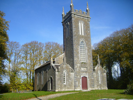 Castletown Church (Kilcornan)Church/chapel · 248 yd
 school337 ydIndicatedFairy fort / earthen ringfort · 1745 yd
 Sweet Chestnut1.7 miSweet Chestnut1.7 miRingmoylan PierVisitor information · 1.9 mi
_-_geograph.org.uk_-_6538081.jpg/250px-Castles_of_Munster,_Shanpallas,_Limerick_(1)_-_geograph.org.uk_-_6538081.jpg "Photo: Garry Dickinson, Wikimedia Commons · CC BY-SA 2.0") Shanpallas CastleCastle · 2.1 mi
Shanpallas CastleCastle · 2.1 mi Castle (in ruins)Castle, tower house · 2.1 miHorse RockNamed rock · 2.3 mi
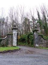 Curraghchase Forest ParkForest · 3.1 mi
 Shannon Airport Aviation GalleryMuseum · 3.6 mi
 Graveyard4.9 mi
More archaeology and monuments in County Limerick · All of County Limerick
What do you know about this place?