
What is recorded here
From the National Monuments Service (Archaeological Survey of Ireland) record CO098-027001
Places near here
Photo credits
- National Inventory of Architectural Heritage
- Maker not stated on source page, www.churchservices.tv
- Maker not stated on source page, www.tripadvisor.com.au
- Maker not stated on source page, www.bigissue.com
- John Allen / The Carrigdhoun, www.carrigdhoun.com
- Maker not stated on source page, ru.pinterest.com
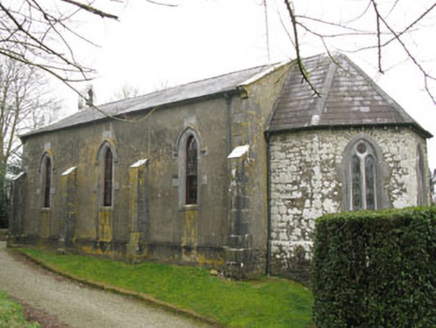 Ballymartle ChurchChurch/chapel · 44 yd
Explorer Tom Ballymartle Church sits on a high spot next to an old graveyard, looking down its nose at the medieval ruins nearby. It…
 Church in Mill-LandChurch · 45 yd
Explorer Tom Church in Mill-Land has a retirement plan that involves slowly disappearing into the earth one brick at a time. It’s…
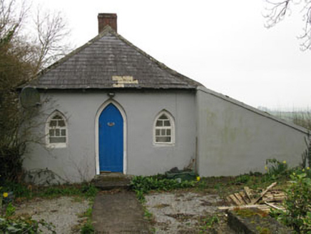 Ballymartle HouseGate lodge · 93 yd
Explorer Tom Ballymartle House gate lodge is plotting how it would survive a zombie apocalypse using its pointed arches as traps.…
 Fairy fort / earthen ringfort in Shanavally (kinalea By., Ballymartle Par.)Fairy fort / earthen ringfort · 190 yd
Explorer Tom Fairy fort in Shanavally is playing hide-and-seek in that pasture. I bet the fairies are still arguing over who gets…
Enclosure in Shanavally (kinalea By., Ballymartle Par.)Enclosure · 306 ydExplorer Tom Enclosure in Shanavally is a puzzle box made of cropmarks. It's got fosses and annexes that look like a maze designed…
 Ballymartle BridgeBridge · 353 yd
Explorer Tom Ballymartle Bridge has been on the Cork to Kinsale road since 1783, so it remembers when horses were the only traffic…
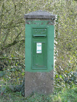 post box373 yd
Explorer Tom Post box in Corruragh is standing guard since 1930 with a raised 'P&T' logo. It’s got a Celtic Revival font that tries…
 vent pipe1486 yd
Explorer Tom Vent pipe in Corruragh on Riverstick is a cast-iron thing with fluting and a cornice, basically wearing a tuxedo to do…
 Fairy fort / earthen ringfort in Coolcarron (kinsale By.)Fairy fort / earthen ringfort · 1.0 mi
Explorer Tom Two lads in a pub once bet this fort in Coolcarron could survive a tractor; they lost badly, but the bank still stands…
 Waterford BridgeBridge · 1.0 mi
Explorer Tom Waterford Bridge in Corruragh is posing for photos even when no one is looking. It used to link Cork and Kinsale, so…
 Ballymartle GAA pitchGAA ground · 1.2 mi
 CastleCastle, unclassified · 2.6 mi
Explorer Tom Castle in Lybe is shown on a 1655 map at Belgooly, but its exact location is a total mystery. There's a mill nearby, so…
More archaeology and monuments in County Cork · All of County Cork

What do you know about this place?Tap to add a comment or ask a question