
Places near here
Photo credits
- Mike Searle, Wikimedia Commons · CC BY-SA 2.0
- National Inventory of Architectural Heritage
- Mike Searle, Geograph · CC BY-SA 2.0
- A.-K. D., Wikimedia Commons · CC BY-SA 4.0
- kevin higgins, Geograph · CC BY-SA 2.0
- Sarah777 at en.wikipedia, Wikimedia Commons · Public domain
- A.-K. D., Wikimedia Commons · CC0
 CastleCastle, tower house · 1406 yd
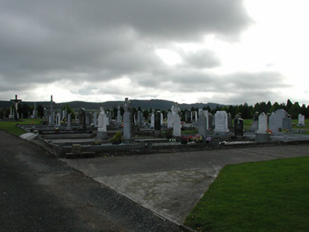 Saint Patrick's Catholic ChurchGraveyard/cemetery · 1612 yd
Explorer Tom Saint Patrick’s graveyard in Garranconnell refuses to fall down because it knows it’s got good stories. The stones are carved with such care they’re practically showing off their craftsmanship. Pretend you're a lost aristocrat looking for your ancestral resting place.
 rectory/glebe/vicarage/curate's house1.1 mi
Explorer Tom Rectory in Newtown claims to be older than the dirt beneath its feet, which is wild. It was built with church money and looks very smug about it all. A handy spot to stretch your legs briefly.
 Tubbrid Castle (in ruins)Castle, tower house · 1.9 mi
 ToberpatrickHoly well · 2.0 mi
 Wellington MonumentViewpoint · 2.0 mi
Explorer Tom Wellington Monument in County Tipperary was built by Sir William Barker in 1817, but legend says he really just wanted a tall pole to hang his laundry from after Waterloo. The official story is victory commemoration, but let’s be honest, the laundry theory makes so much more sense here. Bring curiosity, leave with a better story than mine.
Four Acre WoodForest · 2.2 miExplorer Tom Four Acre Wood witnessed a love story where two people hid in the trees, argued, broke up, and then moved to different continents. The four acres are still emotionally scarred by the drama. Bring someone who'll believe anything.
 TobermurryHoly well · 2.6 mi
Explorer Tom Tobermurry is Lady’s Well, but nobody visits anymore because they forgot how to say please when asking for a sip. It sits there looking bored by the mill race next door. Count the crows, then count again.
 Clomantagh HillMountain / peak · 3.6 miBregaun HillMountain / peak · 4.4 mi
Explorer Tom Bregaun Hill in County Tipperary would survive a zombie attack by simply sitting still and letting them walk right past it without noticing anything interesting to bite. It is the ultimate low-profile survivor strategy and works surprisingly well against the undead horde. Best visited with a curious kid and no timetable.
 John HelyMemorial · 4.6 mi
More archaeology and monuments in County Kilkenny · All of County Kilkenny

What do you know about this place?Tap to add a comment or ask a question