What is recorded here
Rectangular-shaped graveyard (dims. 96m N-S x 60m E-W) to the N of St James' Parish Church (DU018-020346-) which is enclosed by a post-1700 stone wall. Described by Ní Mharcaigh (1997, 276) as; 'The old graveyard, which has some sixteenth-century burials, surrounds it on three sides'. See attached section of Rocque's 1756 Map of Dublin City showing St James' Church and graveyard to the N
Compiled by: Caimin O'Brien
Date of upload: 12 June 2023
From the National Monuments Service (Archaeological Survey of Ireland) record DU018-474
The monument record does not grant public access. Check the route and ask the landowner before entering private land.
- What survives
- Recorded monument
Places near here
Photo credits
- N Chadwick, Geograph · CC BY-SA 2.0
- National Inventory of Architectural Heritage
- Steven Lek, Wikimedia Commons · CC BY-SA 4.0
- Keith Weller, Wikimedia Commons · Public domain
- Paul Shanahan, Wikimedia Commons · CC BY-SA 4.0
- Filip Scridon, Wikimedia Commons · CC BY-SA 4.0
- renee_mcgurk, Wikimedia Commons · CC BY 2.0
 Pearse LyonsHeritage attraction · 45 yd
 Saint James's ChurchChurch/chapel · 46 yd
 RyansHouse · 76 ydField system in Unknown TownlandField system · 164 yd
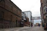 Guinness StorehouseHeritage attraction · 341 yd
 European Pear412 ydLudwig WittgensteinMemorial · 486 yd
_-_20190904133656.jpg/250px-County_Dublin_-_Croppies'_Acre_Memorial_Garden_(Dublin)_-_20190904133656.jpg "Photo: Paul Shanahan, Wikimedia Commons · CC BY-SA 4.0") Croppies Acre MemorialMemorial · 491 yd
Croppies Acre MemorialMemorial · 491 yd Royal BarracksBarracks · 579 ydCastleCastle, unclassified · 595 ydBus Route InformationVisitor information · 664 yd
 Silver maple1154 yd
More archaeology and monuments in County Dublin · All of County Dublin
What do you know about this place?